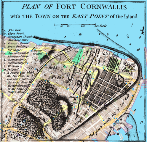
File:The Map of Early Penang Showing the Malay Town on the South of the Town Center by Popham 1799 overlaid with OSM.png
Jump to navigation
Jump to search

Size of this preview: 619 × 599 pixels. Other resolutions: 248 × 240 pixels | 496 × 480 pixels | 793 × 768 pixels | 1,057 × 1,024 pixels | 2,024 × 1,960 pixels.
Original file (2,024 × 1,960 pixels, file size: 593 KB, MIME type: image/png)
File history
Click on a date/time to view the file as it appeared at that time.
| Date/Time | Thumbnail | Dimensions | User | Comment | |
|---|---|---|---|---|---|
| current | 13:43, 8 March 2024 | | 2,024 × 1,960 (593 KB) | commons>Cmglee | Uploaded a work by OpenStreetMap contributors, Sir Home Riggs Popham from OpenStreetMap, and Popham, Home Riggs. Description of Prince of Wales Island in the Straits of Malacca with Its Advantages as a Marine Establishment. London. with UploadWizard |
File usage
There are no pages that use this file.