File:Templer transport map.svg
Jump to navigation
Jump to search

Size of this PNG preview of this SVG file: 800 × 348 pixels. Other resolutions: 320 × 139 pixels | 640 × 278 pixels | 1,024 × 445 pixels | 1,280 × 557 pixels | 2,560 × 1,113 pixels | 1,437 × 625 pixels.
Original file (SVG file, nominally 1,437 × 625 pixels, file size: 270 KB)
| Description |
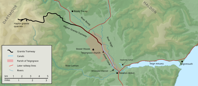
Map of the lower Teign valley and estuary with the following shown:
|
| Date | |
| Source |
Includes data from the following Ordnance Survey OpenData products:
|
| Author | Nilfanion, created using Ordnance Survey data |
| Permission (Reusing this file) |
This file is licensed under the Creative Commons Attribution-Share Alike 3.0 Unported license. Attribution: Contains Ordnance Survey data © Crown copyright and database right
|
File history
Click on a date/time to view the file as it appeared at that time.
| Date/Time | Thumbnail | Dimensions | User | Comment | |
|---|---|---|---|---|---|
| current | 15:28, 2 July 2016 | | 1,437 × 625 (270 KB) | commons>Smalljim | Added more names. Used Inkscape's simplify function on contours to reduce filesize. |
File usage
There are no pages that use this file.