File:Telford and Wrekin UK locator map.svg
Jump to navigation
Jump to search

Size of this PNG preview of this SVG file: 550 × 599 pixels. Other resolutions: 220 × 240 pixels | 441 × 480 pixels | 705 × 768 pixels | 940 × 1,024 pixels | 1,880 × 2,048 pixels | 1,198 × 1,305 pixels.
Original file (SVG file, nominally 1,198 × 1,305 pixels, file size: 945 KB)
File history
Click on a date/time to view the file as it appeared at that time.
| Date/Time | Thumbnail | Dimensions | User | Comment | |
|---|---|---|---|---|---|
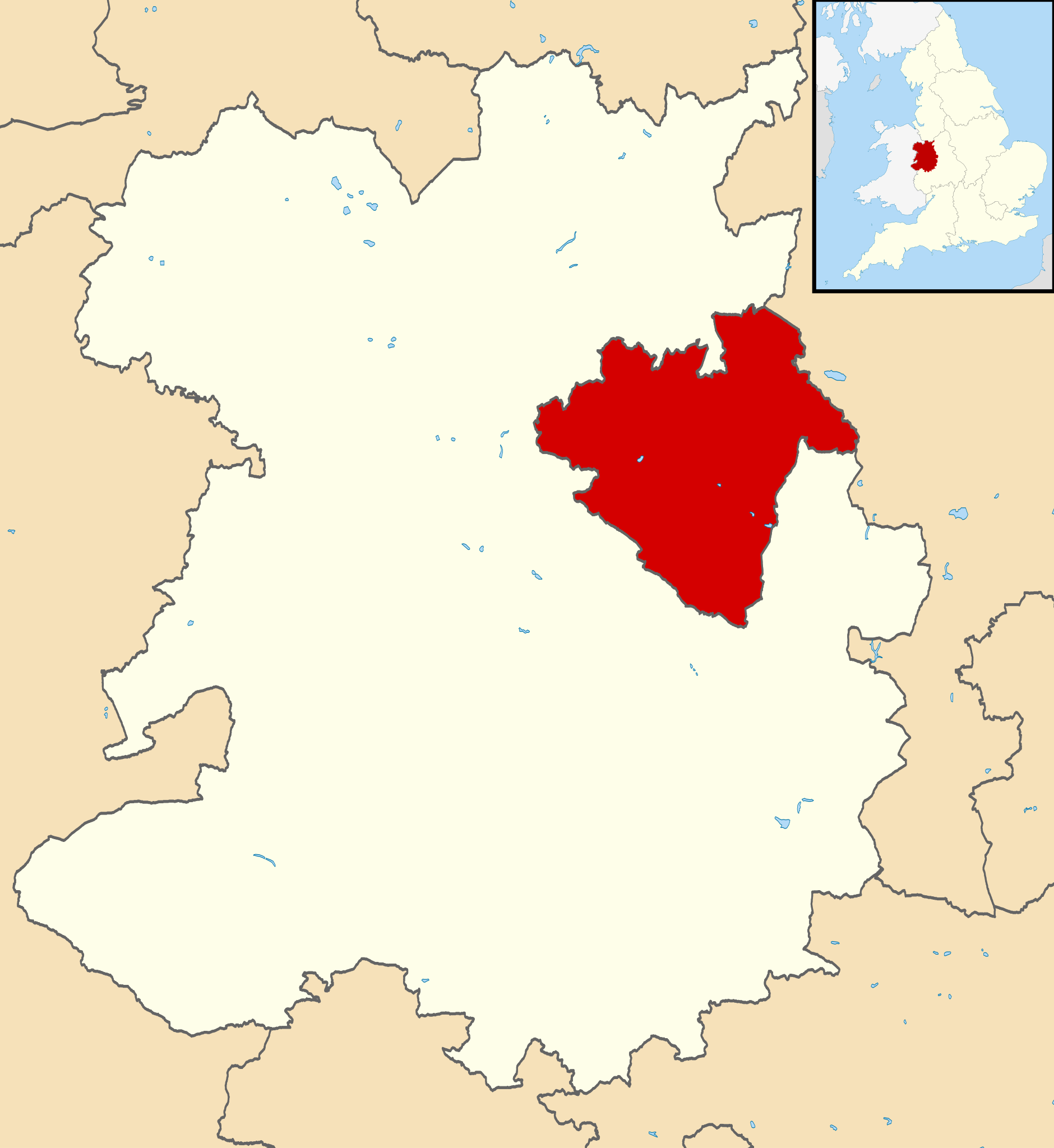
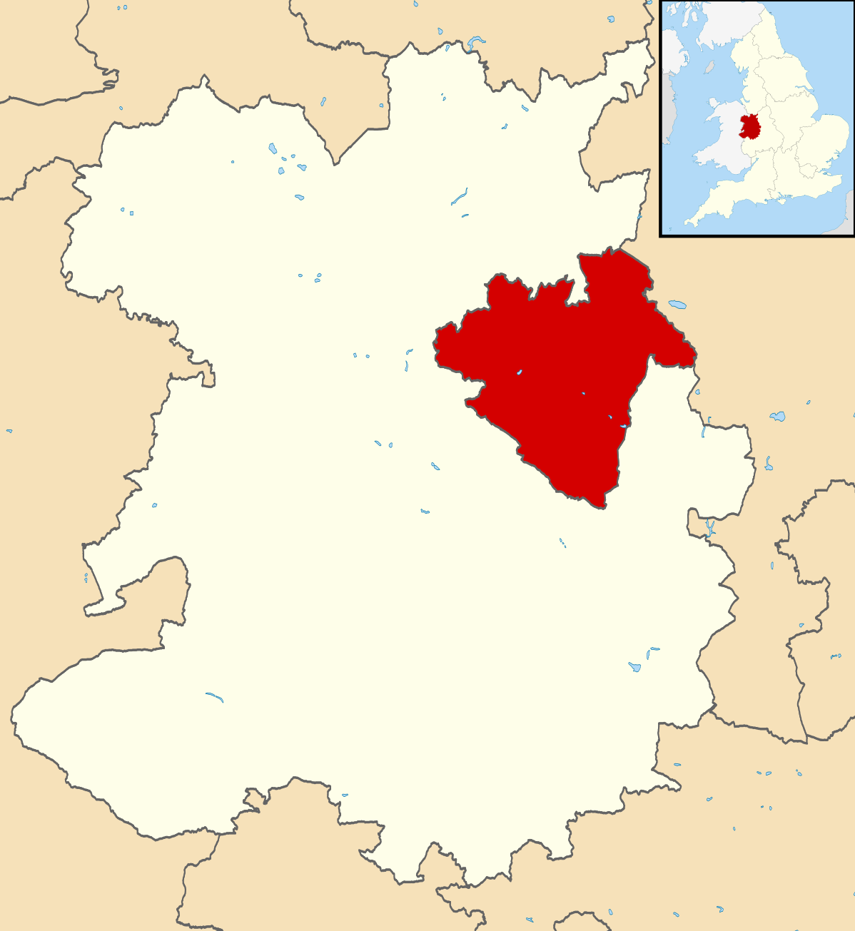
| current | 21:20, 1 September 2013 | | 1,198 × 1,305 (945 KB) | commons>Nilfanion | {{Information |Description=Map of Shropshire, UK with Telford and Wrekin highlighted. Equirectangular map projection on WGS 84 datum, with N/S stretched 165% |Source=Ordnance Survey [https://www.ordnancesurvey.co... |
File usage
There are no pages that use this file.