File:Taunton road map1948.jpg
Jump to navigation
Jump to search

Size of this preview: 664 × 600 pixels. Other resolutions: 266 × 240 pixels | 531 × 480 pixels | 850 × 768 pixels | 1,241 × 1,121 pixels.
Original file (1,241 × 1,121 pixels, file size: 735 KB, MIME type: image/jpeg)
File history
Click on a date/time to view the file as it appeared at that time.
| Date/Time | Thumbnail | Dimensions | User | Comment | |
|---|---|---|---|---|---|
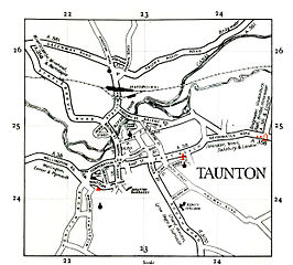
| current | 18:36, 25 August 2009 | | 1,241 × 1,121 (735 KB) | commons>Sv1xv | {{Information |Description={{en|1=OS map of Taunton area, UK.}} |Source=Ordnance Survey map, originally uploaded on en.wiki under same name. |Author=Ordnance Survey |Date=1948 |Permission= |other_versions= }} =={{int:license}}== {{OldOS}} ==Original uplo |
File usage
There are no pages that use this file.