File:Tateyama Kurobe Alpine Route, Map (English).jpg
Jump to navigation
Jump to search
Size of this preview: 800 × 400 pixels. Other resolutions: 320 × 160 pixels | 640 × 320 pixels | 1,024 × 512 pixels | 1,280 × 640 pixels | 2,560 × 1,280 pixels | 4,990 × 2,495 pixels.
Original file (4,990 × 2,495 pixels, file size: 7.59 MB, MIME type: image/jpeg)
.jpg)
File history
Click on a date/time to view the file as it appeared at that time.
| Date/Time | Thumbnail | Dimensions | User | Comment | |
|---|---|---|---|---|---|
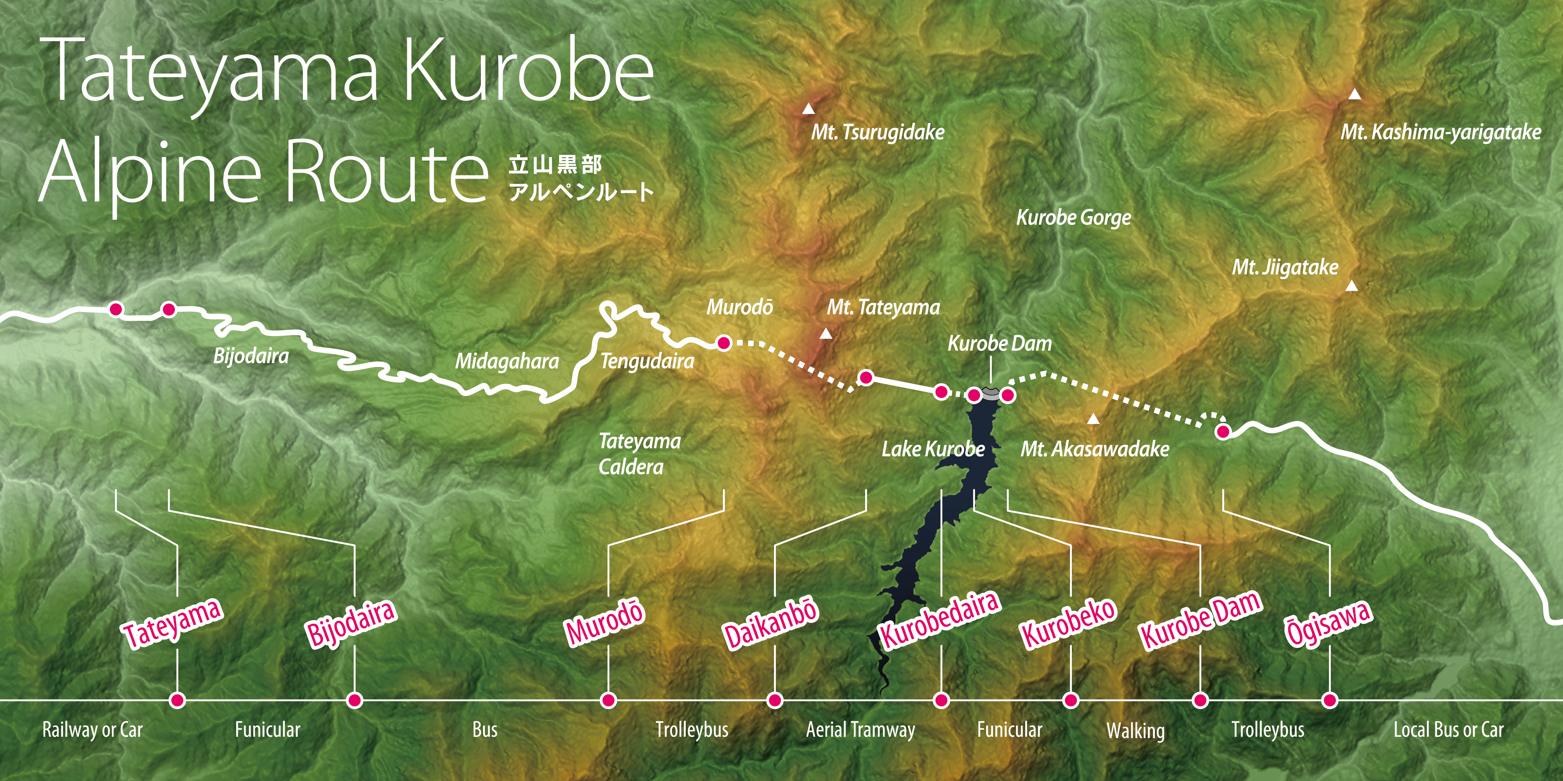
| current | 12:16, 5 March 2016 | | 4,990 × 2,495 (7.59 MB) | commons>Batholith | {{Information |Description= {{en|Map of Tateyama Kurobe Alpine Route, Chūbu region, Honshu, Japan. Data from "SRTM-1 (30m Mesh) Ver.3 2... |
File usage
There are no pages that use this file.
.jpg)