File:Tandridge UK local election 2007 map.svg
Jump to navigation
Jump to search

Size of this PNG preview of this SVG file: 453 × 600 pixels. Other resolutions: 181 × 240 pixels | 362 × 480 pixels | 580 × 768 pixels | 773 × 1,024 pixels | 1,546 × 2,048 pixels | 956 × 1,266 pixels.
Original file (SVG file, nominally 956 × 1,266 pixels, file size: 378 KB)
File history
Click on a date/time to view the file as it appeared at that time.
| Date/Time | Thumbnail | Dimensions | User | Comment | |
|---|---|---|---|---|---|
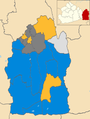
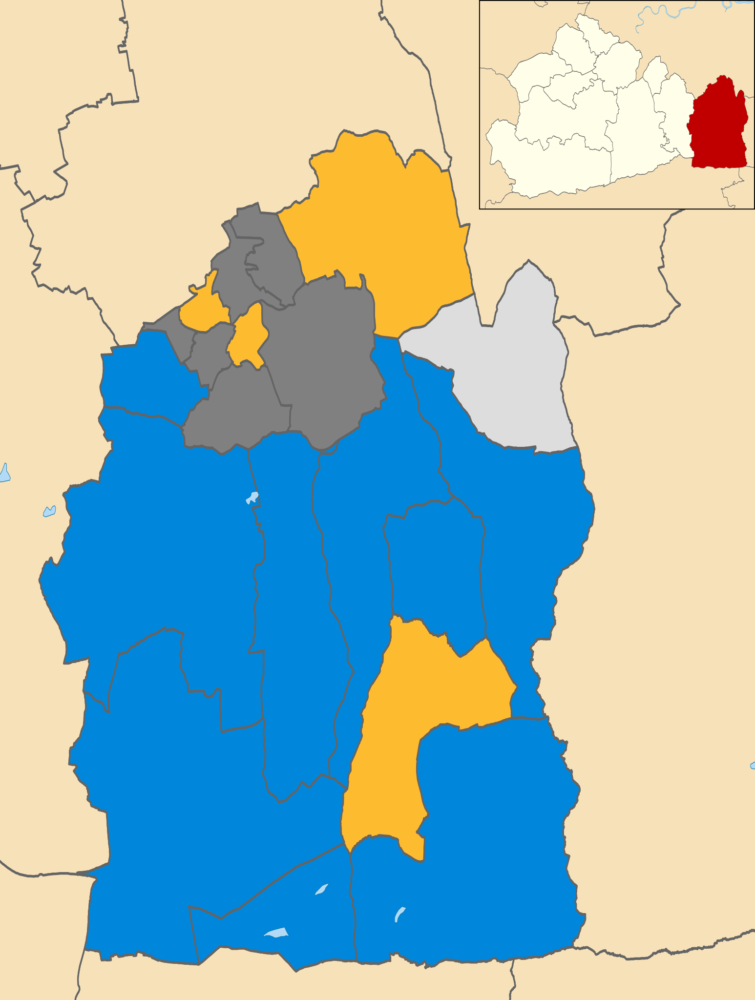
| current | 18:47, 6 January 2012 | | 956 × 1,266 (378 KB) | commons>Davewild | == {{int:filedesc}} == {{Information |Description=Map of Tandridge, Surrey, UK showing the results of the 2007 local election. Colours: {{legend|#0087dc|Conservative}} {{legend|#fdbb30|Liberal Democrat}} {{legend|#dddddd|Independent}} Wards in dark grey |
File usage
There are no pages that use this file.