File:TahitiMooreaMap.png
Jump to navigation
Jump to search

Size of this preview: 800 × 598 pixels. Other resolutions: 320 × 239 pixels | 640 × 479 pixels | 979 × 732 pixels.
Original file (979 × 732 pixels, file size: 16 KB, MIME type: image/png)
File history
Click on a date/time to view the file as it appeared at that time.
| Date/Time | Thumbnail | Dimensions | User | Comment | |
|---|---|---|---|---|---|
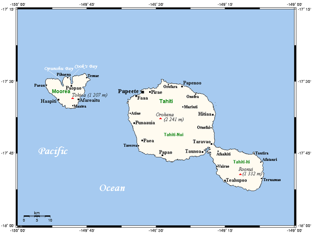
| current | 08:47, 11 February 2009 | | 979 × 732 (16 KB) | commons>Telim tor | == Information == {{Information |Description={{en|A map of Tahiti and Moorea in the Society Islands, French Polynesia}} |Source=This map's source is [http://www.aquarius.ifm-geomar.de/ here], with the uploader's modifications, and the [http://gmt.soest.ha |
File usage
There are no pages that use this file.