File:TNF-NASAmap-Labels.png
Jump to navigation
Jump to search
No higher resolution available.
TNF-NASAmap-Labels.png (720 × 436 pixels, file size: 431 KB, MIME type: image/png)
File history
Click on a date/time to view the file as it appeared at that time.
| Date/Time | Thumbnail | Dimensions | User | Comment | |
|---|---|---|---|---|---|
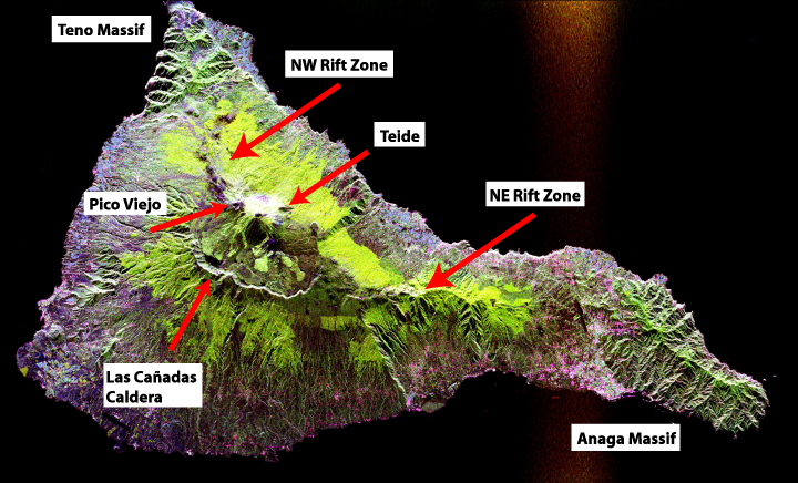
| current | 11:12, 12 October 2007 | | 720 × 436 (431 KB) | commons>ExtraFossiliferous | Edited from original file to add in geological labels (the Teide/Pico Viejo massif, rift zones, Miocence shield volcano massifs and the Las Cañadas Caldera) Space radar image of Teide, taken in 1994. NASA's description: :This radar image shows the Teide |
File usage
There are no pages that use this file.