File:Szatmar county map.jpg
Jump to navigation
Jump to search
Size of this preview: 773 × 600 pixels. Other resolutions: 310 × 240 pixels | 619 × 480 pixels | 990 × 768 pixels | 1,280 × 993 pixels | 2,100 × 1,629 pixels.
Original file (2,100 × 1,629 pixels, file size: 521 KB, MIME type: image/jpeg)
File history
Click on a date/time to view the file as it appeared at that time.
| Date/Time | Thumbnail | Dimensions | User | Comment | |
|---|---|---|---|---|---|
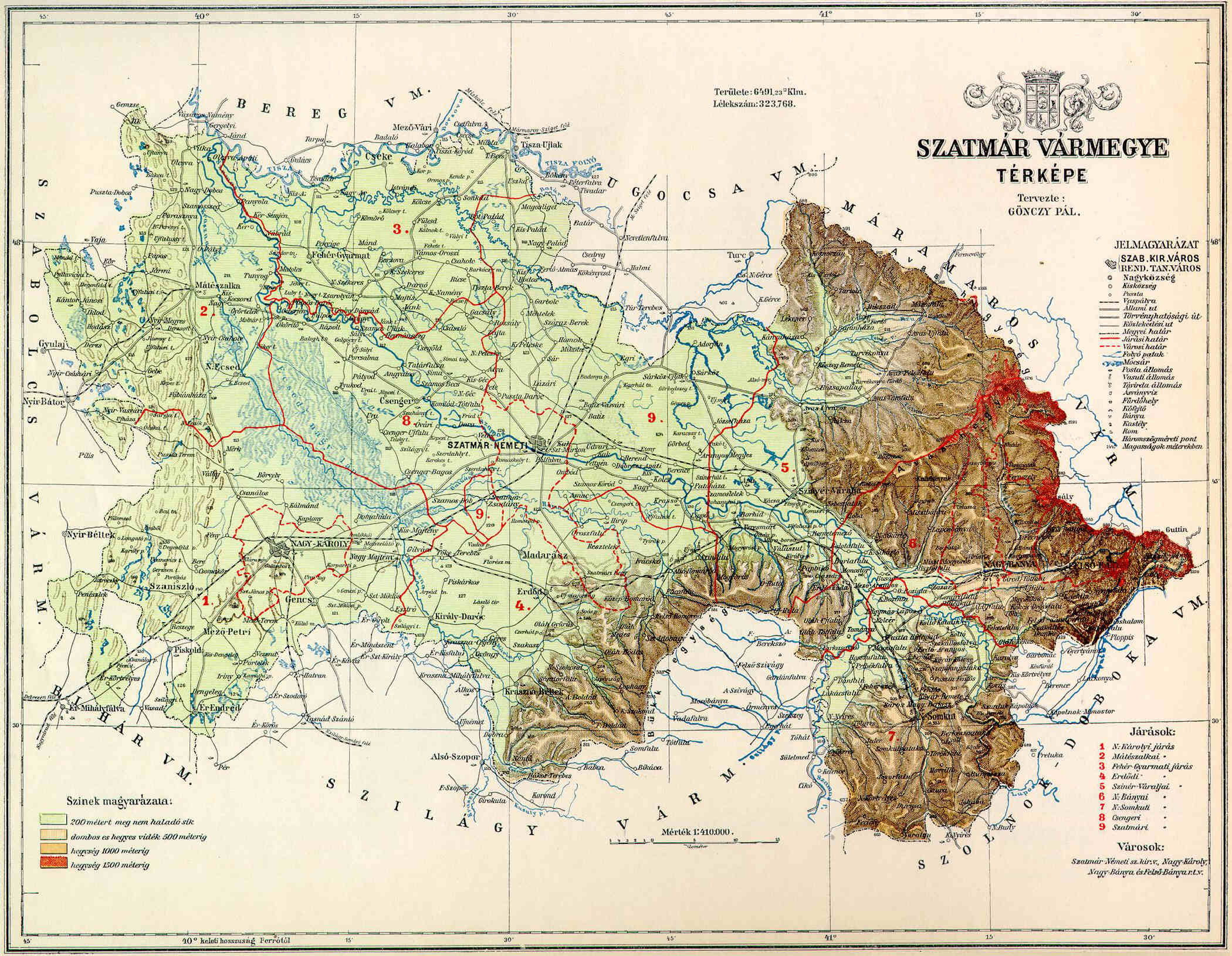
| current | 20:34, 10 November 2006 | | 2,100 × 1,629 (521 KB) | commons>PM | {{Information |Description=County of Szatmár in the pre-Trianon Kingdom of Hungary. <br>Komitat Szatmár w Królestwie Węgier przed traktatem w Trianon. |Source=hu:Kép:Szatmár vármegye térképe.jpg uploaded by hu:User:Kla |Date=not given |
File usage
There are no pages that use this file.