File:Sydney districts 1824.jpg
Jump to navigation
Jump to search
Size of this preview: 616 × 599 pixels. Other resolutions: 247 × 240 pixels | 493 × 480 pixels | 790 × 768 pixels | 1,063 × 1,034 pixels.
Original file (1,063 × 1,034 pixels, file size: 360 KB, MIME type: image/jpeg)
File history
Click on a date/time to view the file as it appeared at that time.
| Date/Time | Thumbnail | Dimensions | User | Comment | |
|---|---|---|---|---|---|
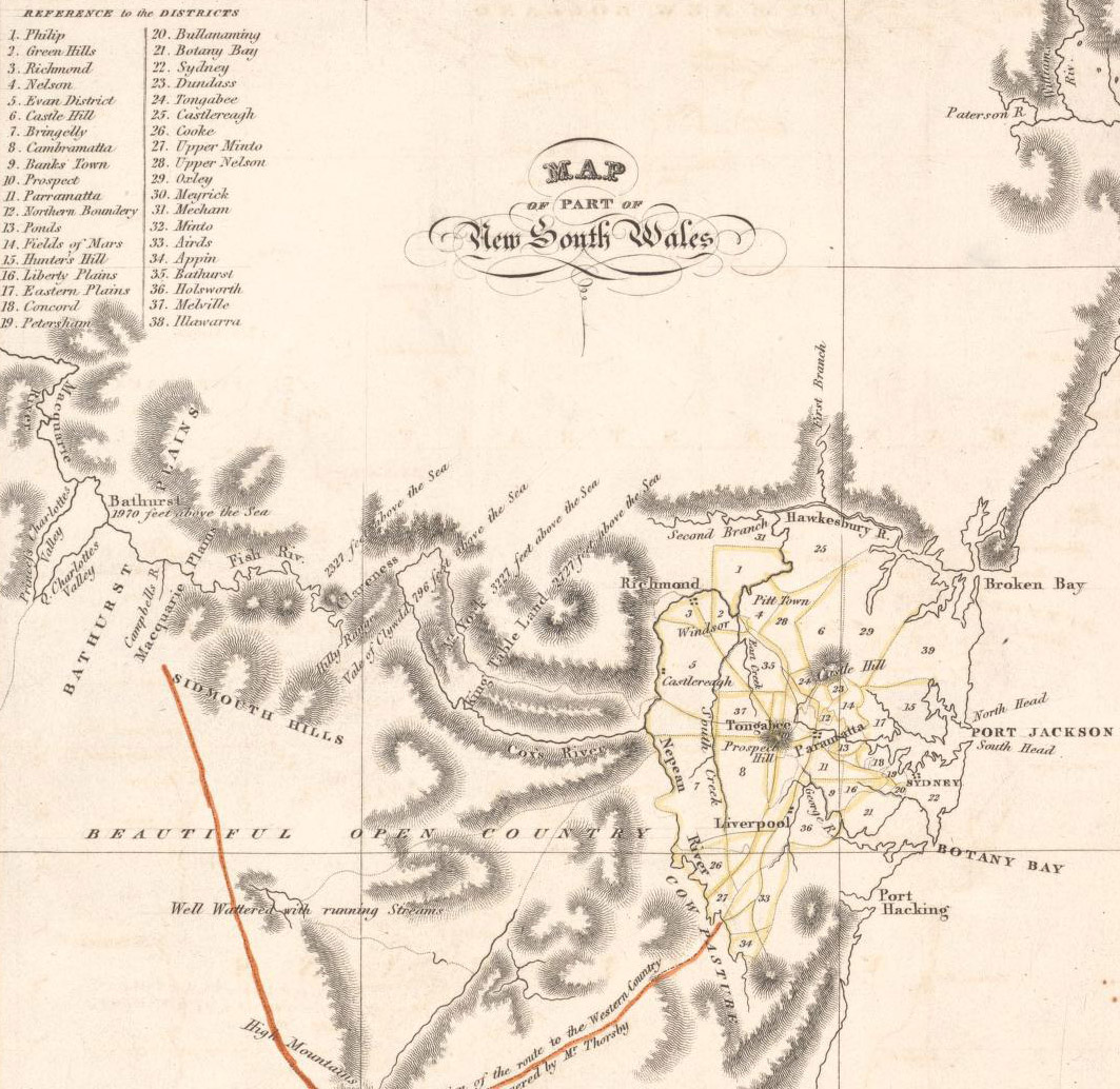
| current | 12:08, 3 April 2007 | | 1,063 × 1,034 (360 KB) | commons>Roke~commonswiki | Map of districts in Sydney, 1824. Old map from the National Library, located [http://nla.gov.au/nla.map-nk2456-106 here] Title:Map of Van Diemans Land; Map of part of New South Wales [cartographic material] / drawn & engraved by W. H. Lizars Edinr. Creat |
File usage
There are no pages that use this file.