File:Sweetwater river map.jpg
Jump to navigation
Jump to search

Size of this preview: 800 × 501 pixels. Other resolutions: 320 × 200 pixels | 640 × 401 pixels | 1,071 × 671 pixels.
Original file (1,071 × 671 pixels, file size: 353 KB, MIME type: image/jpeg)
File history
Click on a date/time to view the file as it appeared at that time.
| Date/Time | Thumbnail | Dimensions | User | Comment | |
|---|---|---|---|---|---|
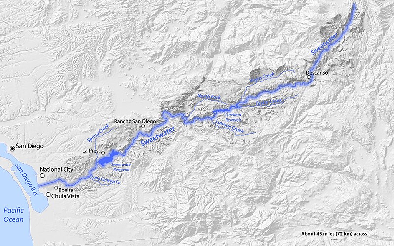
| current | 03:13, 22 January 2011 | | 1,071 × 671 (353 KB) | commons>Shannon1 | {{Information |Description={{en|1=Map of the Sweetwater River watershed in southern California, USA}} |Source=Topography from [http://seamless.usgs.gov/website/seamless/viewer.htm USGS Seamless viewer] |Author=Shannon1 |Date=2011-01-20 to 21 |Permission= |
File usage
There are no pages that use this file.