File:Stagonopleura guttata 1 - Glen Alice.jpg
From WikiProjectMed
Jump to navigation
Jump to search
Size of this preview: 800 × 533 pixels. Other resolutions: 320 × 213 pixels | 640 × 427 pixels | 1,024 × 683 pixels | 1,280 × 853 pixels | 2,560 × 1,707 pixels | 3,886 × 2,591 pixels.
Original file (3,886 × 2,591 pixels, file size: 3.18 MB, MIME type: image/jpeg)
This file is from a shared repository and may be used by other projects. The description on its file description page there is shown below.
Summary
DescriptionStagonopleura guttata 1 - Glen Alice.jpg |
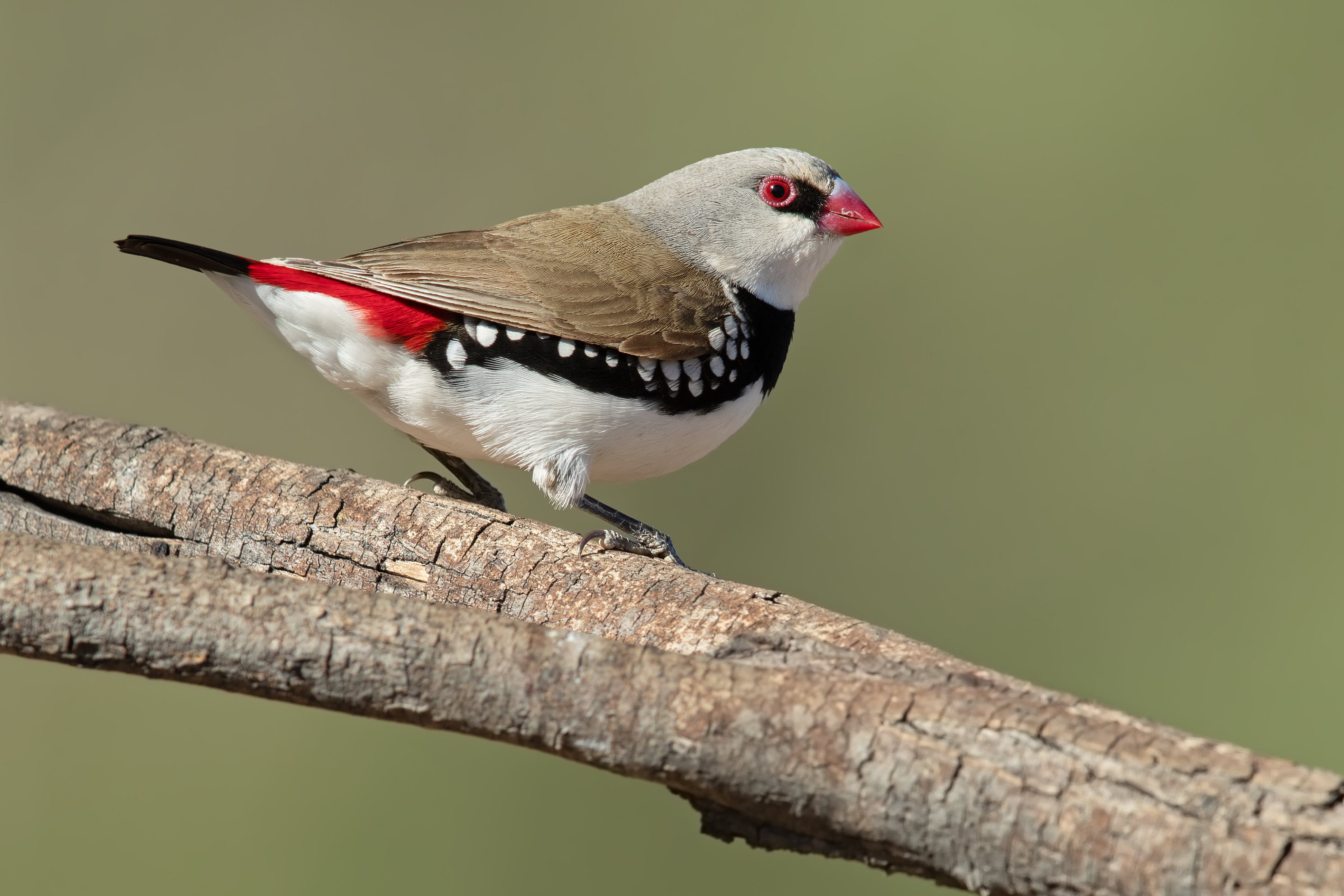
العربية: مُلتهب الذيل الماسي (Stagonopleura guttata)، في ليثگاو، بولاية نيوساوث ويلز الأسترالية.
English: Diamond firetail (Stagonopleura guttata), Glen Alice, Lithgow, New South Wales, Australia |
Date | Taken on 10 November 2019, 07:31:26 |
Source | Own work |
Author | JJ Harrison (https://www.jjharrison.com.au/) |
Camera location | 33° 00′ 00″ S, 150° 00′ 00″ E | View this and other nearby images on: OpenStreetMap | -33.000000; 150.000000 |
---|
Assessment
|
Licensing
I, the copyright holder of this work, hereby publish it under the following license:
This file is licensed under the Creative Commons Attribution-Share Alike 4.0 International license.
- You are free:
- to share – to copy, distribute and transmit the work
- to remix – to adapt the work
- Under the following conditions:
- attribution – You must give appropriate credit, provide a link to the license, and indicate if changes were made. You may do so in any reasonable manner, but not in any way that suggests the licensor endorses you or your use.
- share alike – If you remix, transform, or build upon the material, you must distribute your contributions under the same or compatible license as the original.
Items portrayed in this file
depicts
33°S, 150°E
10 November 2019
0.00199999986262992021 second
10
840 millimetre
400
image/jpeg
File history
Click on a date/time to view the file as it appeared at that time.
Date/Time | Thumbnail | Dimensions | User | Comment | |
---|---|---|---|---|---|
current | 09:36, 12 November 2019 | 3,886 × 2,591 (3.18 MB) | commons>JJ Harrison |
File usage
There are no pages that use this file.
Metadata
This file contains additional information, probably added from the digital camera or scanner used to create or digitize it.
If the file has been modified from its original state, some details may not fully reflect the modified file.
Camera manufacturer | Canon |
---|---|
Camera model | Canon EOS-1D X Mark II |
Author | John Harrison |
Exposure time | 8,589,934/4,294,967,295 sec (0.0019999998626299) |
F Number | f/10 |
ISO speed rating | 400 |
Date and time of data generation | 07:31, 10 November 2019 |
Lens focal length | 840 mm |
Latitude | 33° 3′ 35.68″ S |
Longitude | 150° 5′ 13.48″ E |
Altitude | 504.8 meters above sea level |
Width | 4,318 px |
Height | 2,879 px |
Bits per component |
|
Compression scheme | Uncompressed |
Pixel composition | RGB |
Orientation | Normal |
Number of components | 3 |
Horizontal resolution | 300 dpi |
Vertical resolution | 300 dpi |
Data arrangement | chunky format |
Software used | Adobe Photoshop CC 2017 (Windows) |
File change date and time | 16:19, 10 November 2019 |
Exposure Program | Aperture priority |
Exif version | 2.2 |
Date and time of digitizing | 07:31, 10 November 2019 |
APEX shutter speed | 8.9657840946013 |
APEX aperture | 6.6438560571498 |
APEX exposure bias | 0.333333342957 |
Maximum land aperture | 5 APEX (f/5.66) |
Metering mode | Center weighted average |
Flash | Flash did not fire |
DateTime subseconds | 44 |
DateTimeOriginal subseconds | 44 |
DateTimeDigitized subseconds | 44 |
Color space | sRGB |
Focal plane X resolution | 1,520 |
Focal plane Y resolution | 1,520 |
Focal plane resolution unit | 3 |
Custom image processing | Normal process |
Exposure mode | Auto exposure |
White balance | Manual white balance |
Scene capture type | Standard |
GPS time (atomic clock) | 21:29:38.070999266833 |
Satellites used for measurement | 7 |
Receiver status | Measurement in progress |
Measurement mode | 3-dimensional measurement |
Measurement precision | Good (1.7000000477745) |
Geodetic survey data used | WGS-84 |
GPS date | 9 November 2019 |
GPS tag version | 0.0.3.2 |
Serial number of camera | 075012000013 |
Lens used | EF600mm f/4L IS II USM +1.4x III |
Rating (out of 5) | 0 |
Date metadata was last modified | 03:19, 11 November 2019 |
Unique ID of original document | 051B2139782D6AA443C4F9621C65C71D |