File:Sony MN2.jpg
Jump to navigation
Jump to search
Size of this preview: 800 × 450 pixels. Other resolutions: 320 × 180 pixels | 640 × 360 pixels | 1,024 × 576 pixels | 1,280 × 720 pixels | 3,264 × 1,836 pixels.
Original file (3,264 × 1,836 pixels, file size: 1.69 MB, MIME type: image/jpeg)
Summary
| Camera location | | View this and other nearby images on: OpenStreetMap |
|---|
| Description |
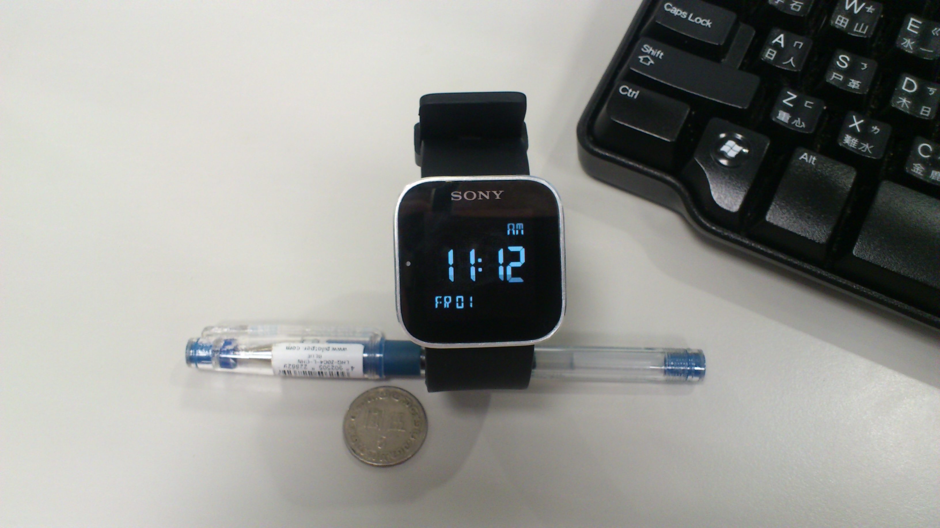
English: Sony SmartWatch MN2
中文(臺灣):Sony 智慧型手錶 SmartWatch MN2 |
| Date | |
| Source | Own work |
| Author | Alexsh |

|
This image has currency in it to indicate scale.
Using coins for scale is discouraged as it will require people unfamiliar with them to look up the dimensions or guess, both of which defeat the purpose of the object in the first place. Coins can also reinforce a geographical bias, and some coins' designs are copyrighted. Ideally, a photograph should include a ruler with the subject (example) or an added scale marking. SI ("metric") units are the most commonly used worldwide (see meter and centimeter). Images with coins to indicate scaleCommon coin diameters for reference:
|
Licensing
I, the copyright holder of this work, hereby publish it under the following license:
This file is licensed under the Creative Commons Attribution-Share Alike 3.0 Unported license.
- You are free:
- to share – to copy, distribute and transmit the work
- to remix – to adapt the work
- Under the following conditions:
- attribution – You must give appropriate credit, provide a link to the license, and indicate if changes were made. You may do so in any reasonable manner, but not in any way that suggests the licensor endorses you or your use.
- share alike – If you remix, transform, or build upon the material, you must distribute your contributions under the same or compatible license as the original.
File history
Click on a date/time to view the file as it appeared at that time.
| Date/Time | Thumbnail | Dimensions | User | Comment | |
|---|---|---|---|---|---|
| current | 13:23, 2 June 2012 | | 3,264 × 1,836 (1.69 MB) | commons>Alexsh |
File usage
There are no pages that use this file.