File:Slateford Aqueduct and Viaduct - geograph.org.uk - 1532265.jpg
Jump to navigation
Jump to search
No higher resolution available.
Slateford_Aqueduct_and_Viaduct_-_geograph.org.uk_-_1532265.jpg (640 × 480 pixels, file size: 79 KB, MIME type: image/jpeg)
Summary
| Description |
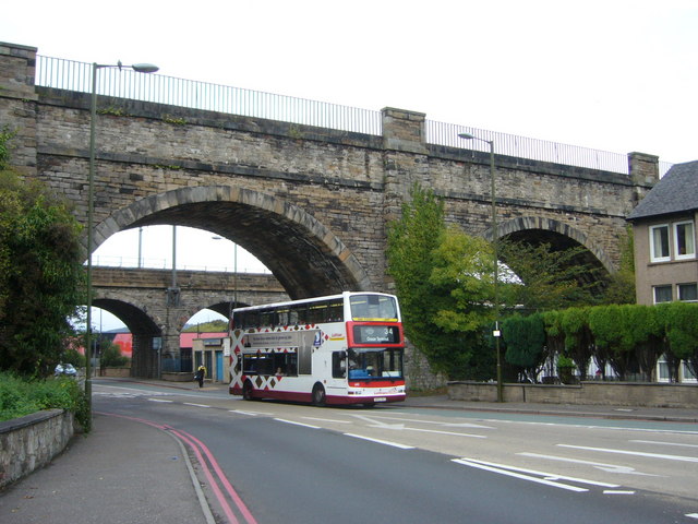
English: Slateford Aqueduct and Viaduct, Edinburgh, Great Britain. The aqueduct in the foreground was built in 1822 to carry the Union Canal across Inglis Green Road and the Water of Leith, its eight arches running for a total length of 600 feet. Thomas Telford described it as "superior perhaps to any aqueduct in the kingdom". The railway viaduct behind it was built in 1847 by William Arrol who went on to build the Bothwell, Broomielaw, second Tay and Forth bridges and London's Tower Bridge. |
| Date | |
| Source | From geograph.org.uk; transferred by User:Ultra7 using geograph_org2commons. |
| Author | kim traynor |
| Permission (Reusing this file) |
Creative Commons Attribution Share-alike license 2.0 |
| Other versions | |
| Attribution (required by the license) | kim traynor / Slateford Aqueduct and Viaduct / |

| Camera location | | View this and other nearby images on: OpenStreetMap |
|---|
| Object location | | View this and other nearby images on: OpenStreetMap |
|---|
_region:GB-GBN_heading:337.00&language=en)
Licensing

|
This image was taken from the Geograph project collection. See this photograph's page on the Geograph website for the photographer's contact details. The copyright on this image is owned by kim traynor and is licensed for reuse under the Creative Commons Attribution-ShareAlike 2.0 license.
|
This file is licensed under the Creative Commons Attribution-Share Alike 2.0 Generic license.
Attribution: kim traynor
- You are free:
- to share – to copy, distribute and transmit the work
- to remix – to adapt the work
- Under the following conditions:
- attribution – You must give appropriate credit, provide a link to the license, and indicate if changes were made. You may do so in any reasonable manner, but not in any way that suggests the licensor endorses you or your use.
- share alike – If you remix, transform, or build upon the material, you must distribute your contributions under the same or compatible license as the original.
File history
Click on a date/time to view the file as it appeared at that time.
| Date/Time | Thumbnail | Dimensions | User | Comment | |
|---|---|---|---|---|---|
| current | 16:40, 15 September 2010 | | 640 × 480 (79 KB) | commons>File Upload Bot (Magnus Manske) | == {{int:filedesc}} == {{Information |Description={{en|1=Slateford Aqueduct and Viaduct, near to Craiglockhart, Edinburgh, Great Britain. The aqueduct in the foreground was built in 1822 to carry the Union Canal across Inglis Green Road and the Water of L |
File usage
There are no pages that use this file.