File:Sierra Leone, administrative divisions - de - colored 2018.svg
Jump to navigation
Jump to search

Size of this PNG preview of this SVG file: 600 × 600 pixels. Other resolutions: 240 × 240 pixels | 480 × 480 pixels | 768 × 768 pixels | 1,024 × 1,024 pixels | 2,048 × 2,048 pixels | 1,606 × 1,606 pixels.
Original file (SVG file, nominally 1,606 × 1,606 pixels, file size: 220 KB)
File history
Click on a date/time to view the file as it appeared at that time.
| Date/Time | Thumbnail | Dimensions | User | Comment | |
|---|---|---|---|---|---|
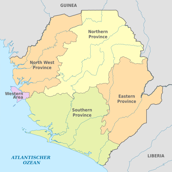
| current | 15:40, 19 January 2018 | | 1,606 × 1,606 (220 KB) | commons>NordNordWest | == {{int:filedesc}} == {{Information |description= {{de|Karte der politischen Gliederung von Sierra Leone, 2018}} {{en|Map of administrative divisions of Sierra Leone, 2018}} |source={{Own using}} {{f|Saarland location map.svg}} by {{U|Lantus}} |date={... |
File usage
There are no pages that use this file.