File:Screenshot 2023-06-07 06.31.25.png
Jump to navigation
Jump to search
Size of this preview: 775 × 600 pixels. Other resolutions: 310 × 240 pixels | 621 × 480 pixels | 993 × 768 pixels | 1,065 × 824 pixels.
Original file (1,065 × 824 pixels, file size: 583 KB, MIME type: image/png)
File history
Click on a date/time to view the file as it appeared at that time.
| Date/Time | Thumbnail | Dimensions | User | Comment | |
|---|---|---|---|---|---|
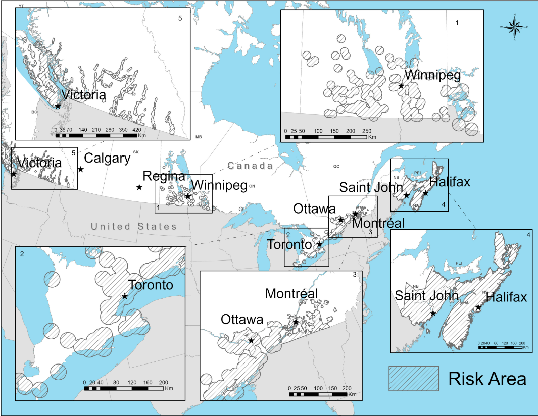
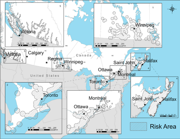
| current | 11:34, 7 June 2023 | | 1,065 × 824 (583 KB) | Doc James | Uploaded a work by Public Health Agency of Canada from https://www.canada.ca/en/public-health/services/diseases/lyme-disease/surveillance-lyme-disease.html with UploadWizard |
File usage
The following page uses this file: