File:Satellite image of South Island New Zealand.jpg
Jump to navigation
Jump to search
Size of this preview: 487 × 599 pixels. Other resolutions: 195 × 240 pixels | 390 × 480 pixels | 624 × 768 pixels | 832 × 1,024 pixels | 1,664 × 2,048 pixels | 2,600 × 3,200 pixels.
Original file (2,600 × 3,200 pixels, file size: 2.08 MB, MIME type: image/jpeg)
File history
Click on a date/time to view the file as it appeared at that time.
| Date/Time | Thumbnail | Dimensions | User | Comment | |
|---|---|---|---|---|---|
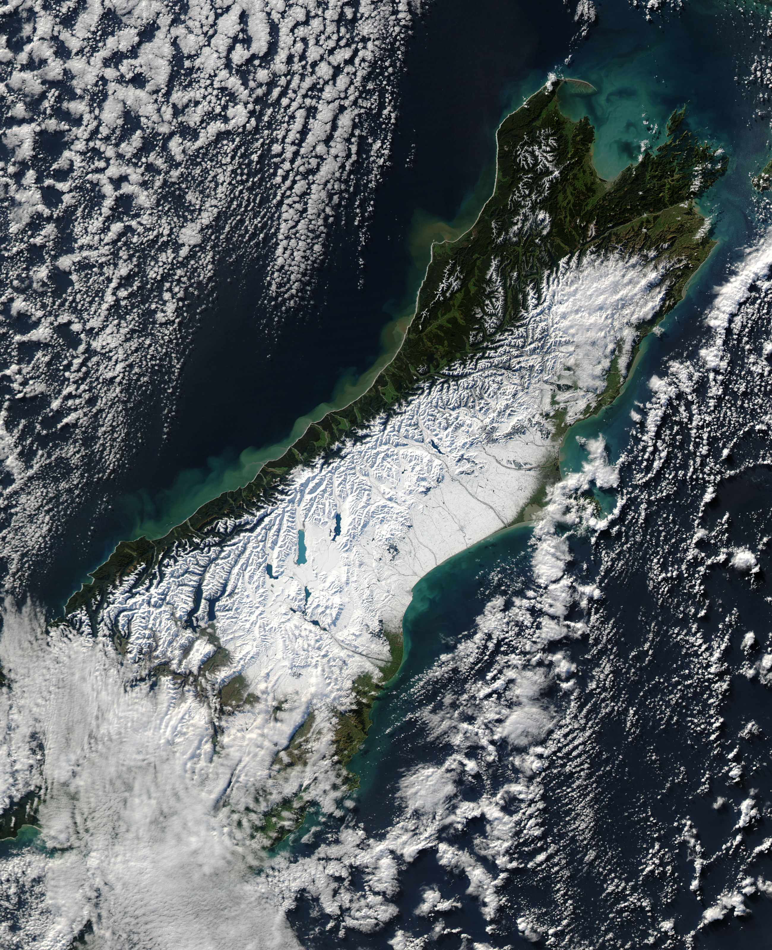
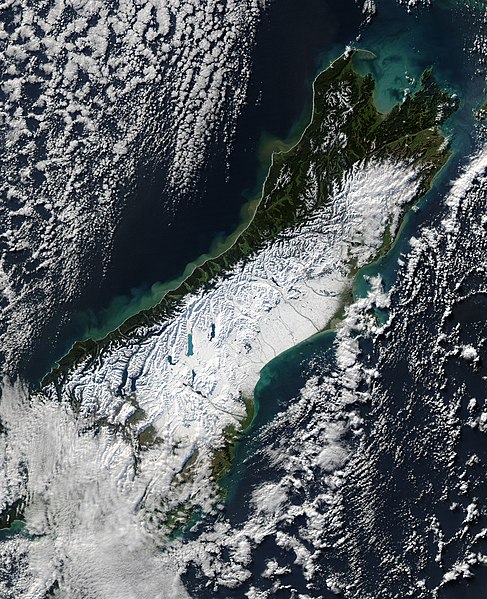
| current | 11:47, 20 June 2006 | | 2,600 × 3,200 (2.08 MB) | commons>Brian | {{PD-USGov-NASA}} Satellite image of the w:South Island of w:New Zealand in June 2005. NASA's description: :A powerful winter storm swept across New Zealand on June 12, 2006. The storm brought strong winds that gusted up to 130 kilometers per h |
File usage
There are no pages that use this file.