File:Sanborn A-Y-P map.jpg
Jump to navigation
Jump to search
Size of this preview: 473 × 600 pixels. Other resolutions: 189 × 240 pixels | 378 × 480 pixels | 605 × 768 pixels | 1,200 × 1,522 pixels.
Original file (1,200 × 1,522 pixels, file size: 390 KB, MIME type: image/jpeg)
File history
Click on a date/time to view the file as it appeared at that time.
| Date/Time | Thumbnail | Dimensions | User | Comment | |
|---|---|---|---|---|---|
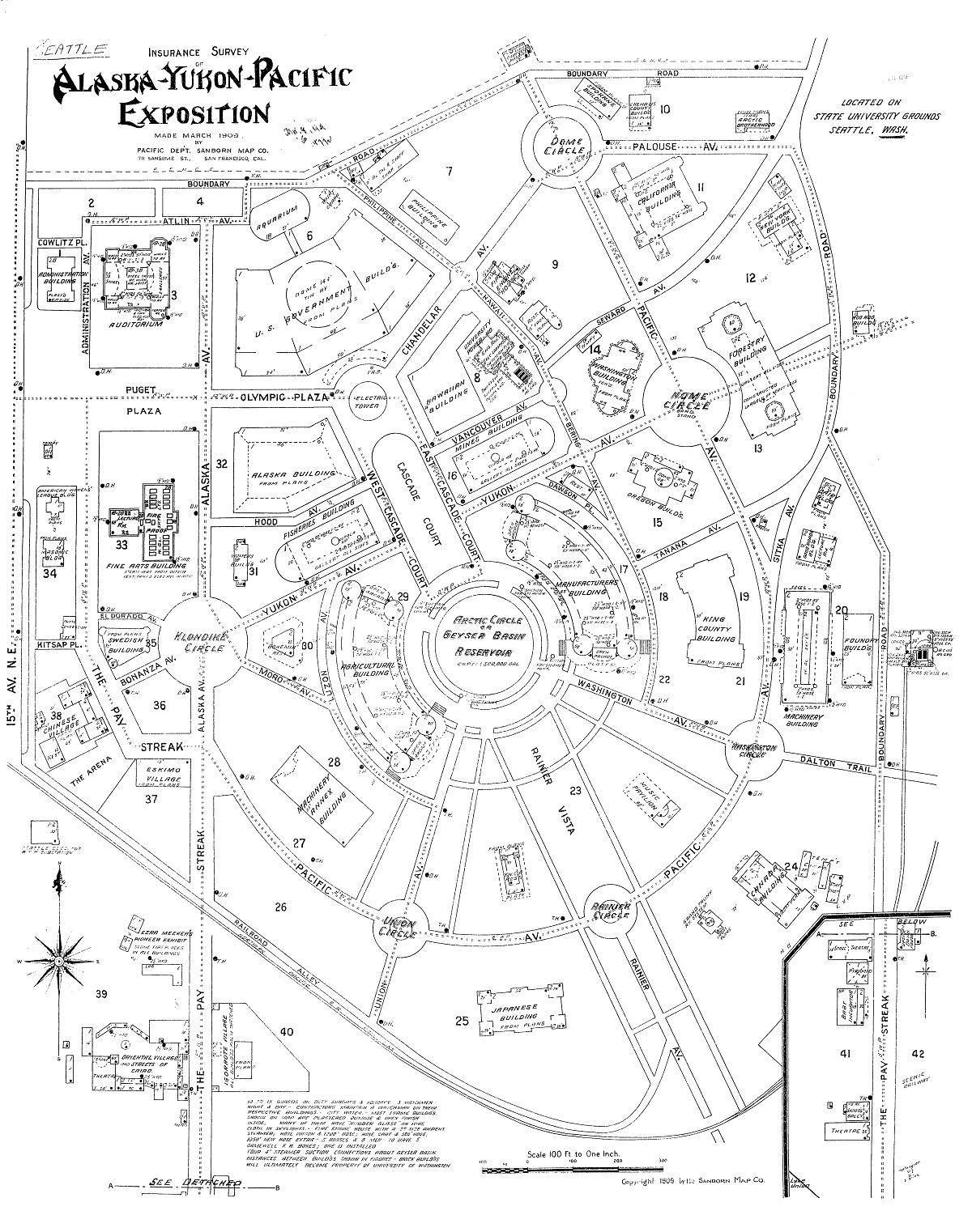
| current | 20:26, 3 October 2008 | | 1,200 × 1,522 (390 KB) | commons>Jmabel | == Summary == {{Information |Description=Map of the Alaska-Yukon-Pacific Exposition (the current University of Washington campus): Insurance Survey of Alaska-Yukon-Pacific Exposition |Source=Digital Sanborn Maps 1867-1970 |Date=March 1909 |Author=Pacific |
File usage
There are no pages that use this file.