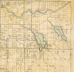
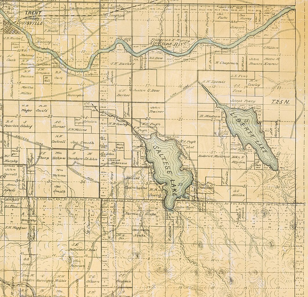
File:Saltese Lake Plat Map (May 1893).jpg
Jump to navigation
Jump to search

Size of this preview: 621 × 599 pixels. Other resolutions: 249 × 240 pixels | 497 × 480 pixels | 796 × 768 pixels | 1,061 × 1,024 pixels | 2,423 × 2,339 pixels.
Original file (2,423 × 2,339 pixels, file size: 3.91 MB, MIME type: image/jpeg)
.jpg)
File history
Click on a date/time to view the file as it appeared at that time.
| Date/Time | Thumbnail | Dimensions | User | Comment | |
|---|---|---|---|---|---|
| current | 20:40, 11 December 2023 | | 2,423 × 2,339 (3.91 MB) | commons>Locke Cole | Cropped section of File:Spokane County Plat Map (May 1893).jpg showing Saltese Lake and surrounding environment (for reference) as it existed in May 1893. See source file for additional details on origins. Source: [https://lange.spokanelibrary.org/files/original/b01540e450cc0462e56b461e76926fd2.jpg?fbclid=IwAR12Eyzy8v12R1BfkZ-RZXbi0-NmQXqPT4ZAkQGxSP60vKemceHhDahkBAs JPG] from Spokane Public Library (archive URL: https://web.archive.or... |
.jpg)
File usage
There are no pages that use this file.
.jpg)