File:SaltGlaciers ZagrosMtns 20010810.jpg
Jump to navigation
Jump to search
Size of this preview: 800 × 509 pixels. Other resolutions: 320 × 204 pixels | 640 × 407 pixels | 1,149 × 731 pixels.
Original file (1,149 × 731 pixels, file size: 231 KB, MIME type: image/jpeg)
File history
Click on a date/time to view the file as it appeared at that time.
| Date/Time | Thumbnail | Dimensions | User | Comment | |
|---|---|---|---|---|---|
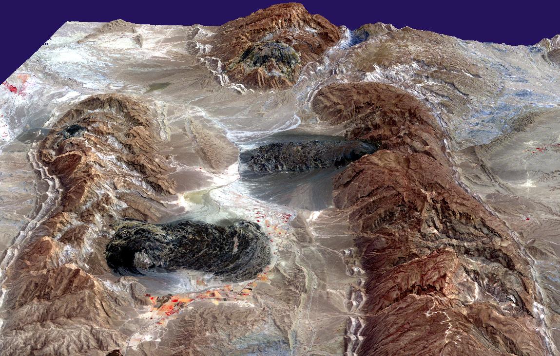
| current | 16:49, 27 April 2006 | | 1,149 × 731 (231 KB) | commons>Holly Cheng | {{Information | Description=Satellite imagery of w:salt domes and w:salt glaciers in the w:Zagros Mountains of southern Iran. This w:ASTER perspective view was created by draping a band 3-2-1 (RGB) image over an ASTER-derived Digital Eleva |
File usage
There are no pages that use this file.