File:Saharan topographic elements map.png
Jump to navigation
Jump to search
Size of this preview: 800 × 395 pixels. Other resolutions: 320 × 158 pixels | 640 × 316 pixels | 1,396 × 690 pixels.
Original file (1,396 × 690 pixels, file size: 757 KB, MIME type: image/png)
File history
Click on a date/time to view the file as it appeared at that time.
| Date/Time | Thumbnail | Dimensions | User | Comment | |
|---|---|---|---|---|---|
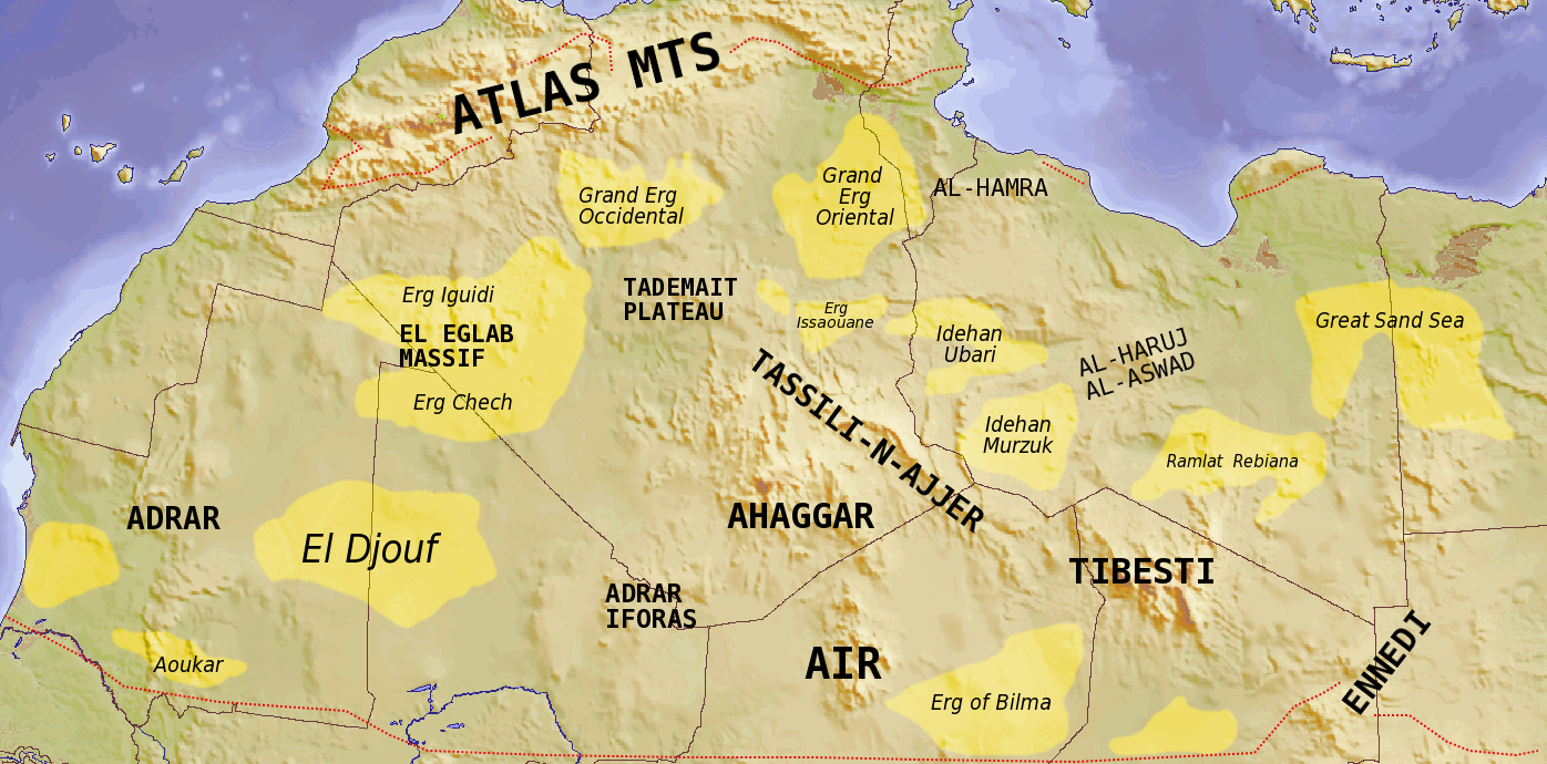
| current | 18:39, 24 July 2008 | | 1,396 × 690 (757 KB) | commons>T L Miles | {{Information |Description={{en|1=Map showing major Dune seas (ergs) and Mountain ranges of the Sahara. Red dashed line shows approximate limit of the Sahara. National borders in grey. Dune seas in yellow. Derived from Blank map [[:Image:Africa_topogra |
File usage
There are no pages that use this file.