File:Sëlva Wolkenstein Selva di Val Gardena Sella.jpg
Jump to navigation
Jump to search

Size of this preview: 800 × 415 pixels. Other resolutions: 320 × 166 pixels | 640 × 332 pixels | 1,024 × 531 pixels | 1,280 × 664 pixels | 2,560 × 1,327 pixels | 11,723 × 6,078 pixels.
Original file (11,723 × 6,078 pixels, file size: 51.52 MB, MIME type: image/jpeg)
Summary
| Description |
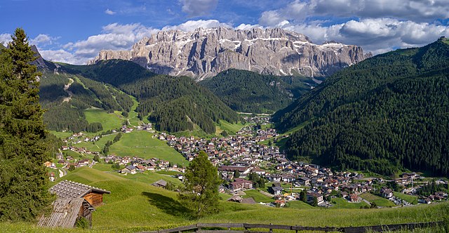
English: View of the town of Sëlva with the Cir and Sella mountain groups
Deutsch: Ansicht von Wolkenstein in Gröden und die Sellagruppe in Südtirol
Italiano: Selva di Val Gardena con i gruppi montani del Cir e Sella e l'Alpe Jac visti dal monte Pic |
||||||
| Date | |||||||
| Source | Own work | ||||||
| Author |
|
||||||
| Permission (Reusing this file) |
Own work, attribution required (Multi-license with GFDL and Creative Commons CC-BY 2.5). Capture: Photo by Wolfgang Moroder | ||||||
| Other versions |
 |


|
NOTE: This image is a panorama of 2 photos consisting of multiple frames that were merged or stitched in software. As a result, this image necessarily underwent some form of digital manipulation. These manipulations may include blending, blurring, cloning, and colour and perspective adjustments. As a result of these adjustments, the image content may be slightly different from reality at the points where multiple images were combined. This manipulation is often required due to lens, perspective, and parallax distortions.
|
| Camera location | | View this and other nearby images on: OpenStreetMap |
|---|
Licensing
I, the copyright holder of this work, hereby publish it under the following license:
This file is licensed under the Creative Commons Attribution-Share Alike 3.0 Unported license.
- You are free:
- to share – to copy, distribute and transmit the work
- to remix – to adapt the work
- Under the following conditions:
- attribution – You must give appropriate credit, provide a link to the license, and indicate if changes were made. You may do so in any reasonable manner, but not in any way that suggests the licensor endorses you or your use.
- share alike – If you remix, transform, or build upon the material, you must distribute your contributions under the same or compatible license as the original.
This image has been assessed using the Quality image guidelines and is considered a Quality image.
|
File history
Click on a date/time to view the file as it appeared at that time.
| Date/Time | Thumbnail | Dimensions | User | Comment | |
|---|---|---|---|---|---|
| current | 06:55, 16 June 2018 | | 11,723 × 6,078 (51.52 MB) | commons>Moroder | cloned sky |
File usage
There are no pages that use this file.