File:Russian-occupied Kherson Oblast administrative divisions.svg
Jump to navigation
Jump to search

Size of this PNG preview of this SVG file: 512 × 401 pixels. Other resolutions: 307 × 240 pixels | 613 × 480 pixels | 981 × 768 pixels | 1,280 × 1,003 pixels | 2,560 × 2,005 pixels.
Original file (SVG file, nominally 512 × 401 pixels, file size: 52 KB)
Summary
| Description |
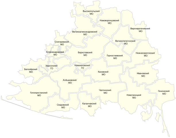
English: A map of Russia's claimed territory in Kherson Oblast and Mykolaiv Oblast, divided up into administrative divisions that were declared by the occupiers. |
| Date | |
| Source | https://khogov.ru/oblast/ |
| Author | Unknown member of the occupation administration, then edited by me to clean up problems. |
Licensing
| This map is ineligible for copyright and therefore in the public domain, because it consists entirely of information that is common property and contains no original authorship. For more information, see Commons:Threshold of originality § Maps.
|
File history
Click on a date/time to view the file as it appeared at that time.
| Date/Time | Thumbnail | Dimensions | User | Comment | |
|---|---|---|---|---|---|
| current | 17:59, 19 June 2023 | | 512 × 401 (52 KB) | commons>HappyWithWhatYouHaveToBeHappyWith | Uploaded a work by Unknown member of the occupation administration, then edited by me to clean up problems. from https://khogov.ru/oblast/ with UploadWizard |
File usage
There are no pages that use this file.