File:Roaring Fork Colorado basin map.png
Jump to navigation
Jump to search
Size of this preview: 633 × 600 pixels. Other resolutions: 253 × 240 pixels | 507 × 480 pixels | 810 × 768 pixels | 1,224 × 1,160 pixels.
Original file (1,224 × 1,160 pixels, file size: 2.22 MB, MIME type: image/png)
File history
Click on a date/time to view the file as it appeared at that time.
| Date/Time | Thumbnail | Dimensions | User | Comment | |
|---|---|---|---|---|---|
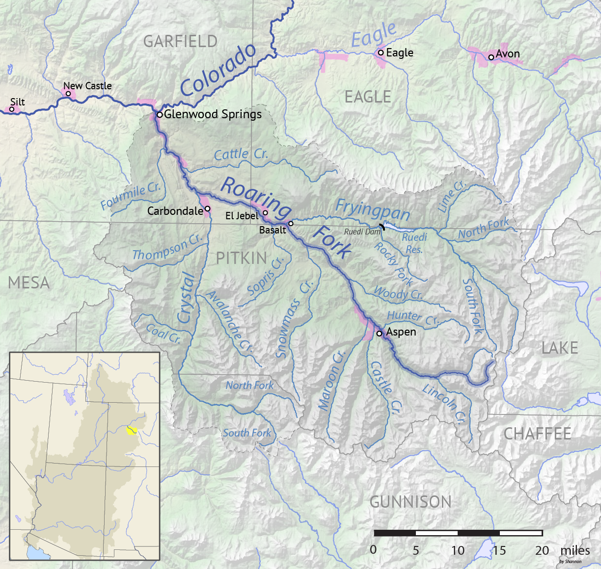
| current | 00:22, 20 May 2018 | | 1,224 × 1,160 (2.22 MB) | commons>Shannon1 | {{Information |description ={{en|1=Map of the Roaring Fork River drainage basin in western Colorado, USA. Made using USGS data.}} |source =Own work |author =Shannon1 |date =2018-05-19 }} Category:Roaring Fork River |
File usage
There are no pages that use this file.