File:Roanoke NASA World Wind.jpg
Jump to navigation
Jump to search

Size of this preview: 800 × 592 pixels. Other resolutions: 320 × 237 pixels | 640 × 474 pixels | 1,024 × 758 pixels | 1,280 × 948 pixels | 1,383 × 1,024 pixels.
Original file (1,383 × 1,024 pixels, file size: 1.26 MB, MIME type: image/jpeg)
File history
Click on a date/time to view the file as it appeared at that time.
| Date/Time | Thumbnail | Dimensions | User | Comment | |
|---|---|---|---|---|---|
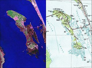
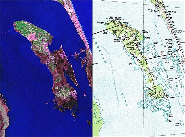
| current | 12:35, 26 May 2010 | | 1,383 × 1,024 (1.26 MB) | commons>Ratzer | {{Information |Description={{en|1=NASA World Wind Geocover 2000 and topographic map coverage of Roanoke Island, North Carolina}} |Source=NASA World Wind Screen Shot |Author=NASA |Date=2000s |Permission= |other_versions= }} [[Category:Maps of North Caroli |
File usage
There are no pages that use this file.