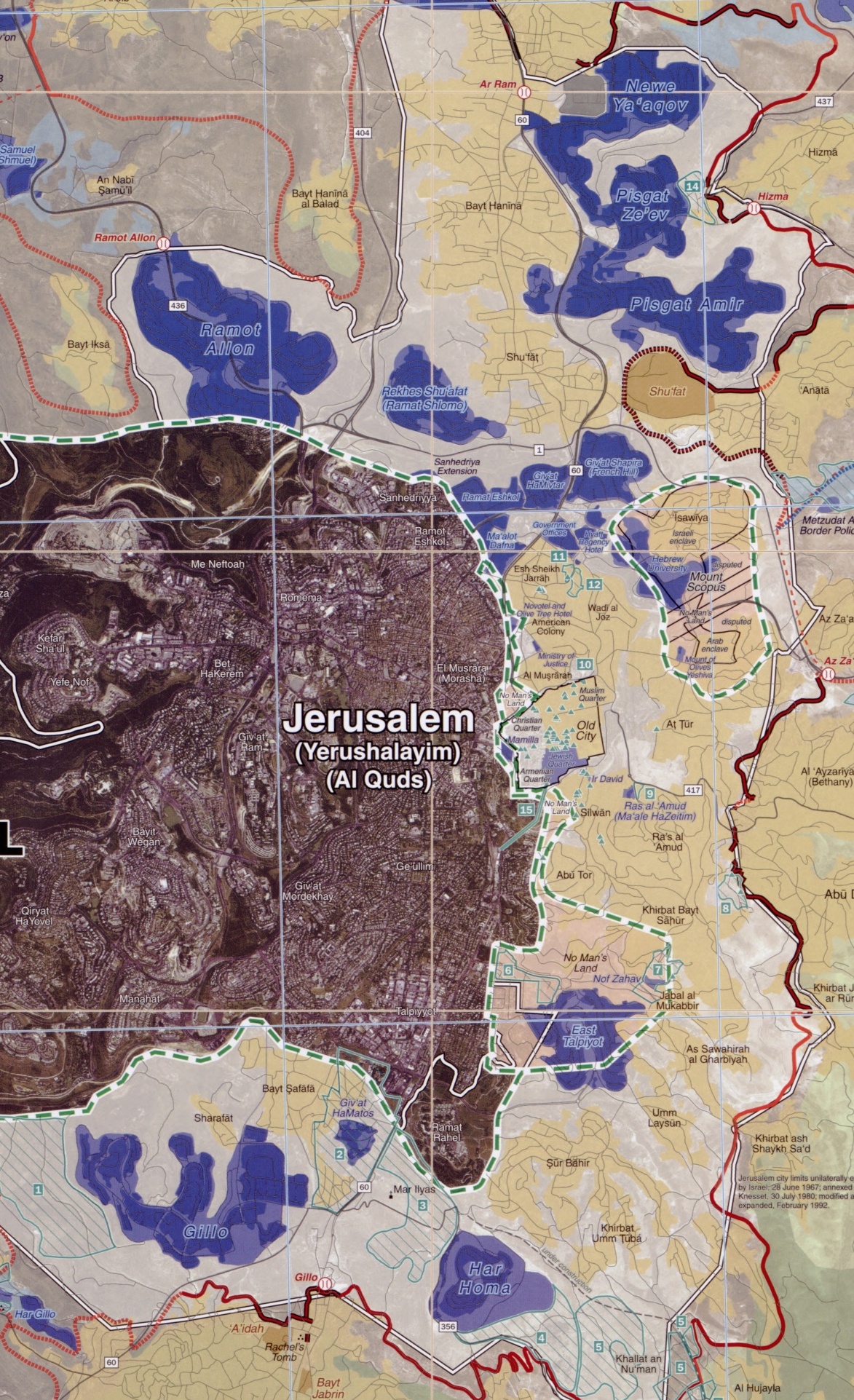
File:Ring Neighborhoods Settlements in Greater Jerusalem May 2006 CIA remote-sensing map 3500px (cropped).jpg
Jump to navigation
Jump to search
Size of this preview: 365 × 598 pixels. Other resolutions: 146 × 240 pixels | 293 × 480 pixels | 468 × 768 pixels | 1,173 × 1,923 pixels.
Original file (1,173 × 1,923 pixels, file size: 1.06 MB, MIME type: image/jpeg)
.jpg)
File history
Click on a date/time to view the file as it appeared at that time.
| Date/Time | Thumbnail | Dimensions | User | Comment | |
|---|---|---|---|---|---|
| current | 21:16, 27 January 2023 | | 1,173 × 1,923 (1.06 MB) | commons>Onceinawhile | File:Greater Jerusalem May 2006 CIA remote-sensing map 3500px.jpg cropped 66 % horizontally, 58 % vertically using CropTool with precise mode. |
File usage
There are no pages that use this file.
.jpg)