File:Rhus typhina range map 4.png
Jump to navigation
Jump to search

Size of this preview: 799 × 599 pixels. Other resolutions: 320 × 240 pixels | 640 × 480 pixels | 1,024 × 768 pixels | 1,280 × 960 pixels | 2,560 × 1,920 pixels | 3,854 × 2,891 pixels.
Original file (3,854 × 2,891 pixels, file size: 243 KB, MIME type: image/png)
Summary
| Description |
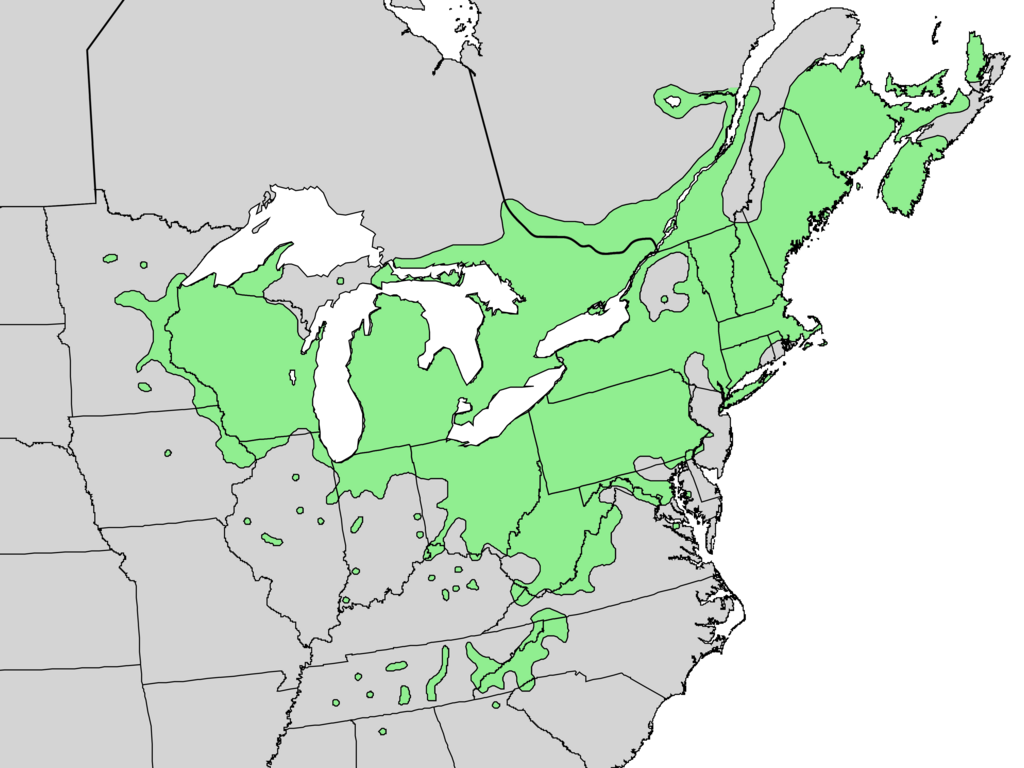
English: Range map of Rhus typhina — native to the Eastern U.S. |
| Date | |
| Source | Digital representation of "Atlas of United States Trees" by Elbert L. Little, Jr. [1] |
| Author | U.S. Geological Survey |
Licensing
This image is in the public domain in the United States because it only contains materials that originally came from the United States Geological Survey, an agency of the United States Department of the Interior. For more information, see the official USGS copyright policy.
|
Original upload log
Transferred from en.wikipedia to Commons by Pinethicket using CommonsHelper.
The original description page was here. All following user names refer to en.wikipedia.
- 2010-05-21 16:37 Masebrock 831×676× (162804 bytes) {{Information |Description=Range map of Rhus typhina |Source=Digital representation of "Atlas of United States Trees" by Elbert L. Little, Jr. [http://esp.cr.usgs.gov/data/atlas/little/] |Date=1999 |Author=U.S. Geological Survey |Permission={{PD-USGov-Int
File history
Click on a date/time to view the file as it appeared at that time.
| Date/Time | Thumbnail | Dimensions | User | Comment | |
|---|---|---|---|---|---|
| current | 20:15, 20 December 2013 | | 3,854 × 2,891 (243 KB) | commons>Nonenmac | no striping, higher resolution, white lakes, province borders added |
File usage
There are no pages that use this file.