File:Rauma panorama.jpg
Jump to navigation
Jump to search

Size of this preview: 800 × 149 pixels. Other resolutions: 320 × 59 pixels | 640 × 119 pixels | 1,024 × 190 pixels | 1,280 × 238 pixels | 2,560 × 475 pixels | 14,000 × 2,600 pixels.
Original file (14,000 × 2,600 pixels, file size: 22.6 MB, MIME type: image/jpeg)
Summary
| Description |
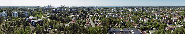
English: A panoramic image of Rauma. Images were taken from the observation deck of Rauma watertower. |
| Date | |
| Source | Own work |
| Author | kallerna |
| Other versions |
|
| Camera location | | View this and other nearby images on: OpenStreetMap |
|---|
Licensing
I, the copyright holder of this work, hereby publish it under the following license:
This file is licensed under the Creative Commons Attribution-Share Alike 3.0 Unported license.
- You are free:
- to share – to copy, distribute and transmit the work
- to remix – to adapt the work
- Under the following conditions:
- attribution – You must give appropriate credit, provide a link to the license, and indicate if changes were made. You may do so in any reasonable manner, but not in any way that suggests the licensor endorses you or your use.
- share alike – If you remix, transform, or build upon the material, you must distribute your contributions under the same or compatible license as the original.
| Annotations | This image is annotated: View the annotations at Commons |
This image has been assessed using the Quality image guidelines and is considered a Quality image.
|
File history
Click on a date/time to view the file as it appeared at that time.
| Date/Time | Thumbnail | Dimensions | User | Comment | |
|---|---|---|---|---|---|
| current | 09:41, 5 April 2020 | 14,000 × 2,600 (22.6 MB) | commons>Kallerna | colour balance |
File usage
There are no pages that use this file.