File:Public Schools Historical Atlas - Roman Britain 400.jpg
Jump to navigation
Jump to search

Size of this preview: 458 × 600 pixels. Other resolutions: 183 × 240 pixels | 367 × 480 pixels | 880 × 1,152 pixels.
Original file (880 × 1,152 pixels, file size: 364 KB, MIME type: image/jpeg)
File history
Click on a date/time to view the file as it appeared at that time.
| Date/Time | Thumbnail | Dimensions | User | Comment | |
|---|---|---|---|---|---|
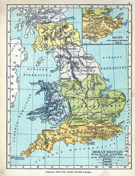
| current | 18:05, 18 June 2009 | | 880 × 1,152 (364 KB) | commons>Yarl | == {{int:filedesc}} == {{Information |Description={{en|Map of Roman Britain in 400.}} |Source= * ''The Public Schools Historical Atlas'' by Charles Colbeck. Longmans, Green; New York; London; Bombay. 1905. * [http://www.lib.utexas.edu/maps/historical/hist |
File usage
There are no pages that use this file.