File:Portsmouth UK local election 2010 map.svg
Jump to navigation
Jump to search

Size of this PNG preview of this SVG file: 516 × 600 pixels. Other resolutions: 206 × 240 pixels | 413 × 480 pixels | 661 × 768 pixels | 881 × 1,024 pixels | 1,762 × 2,048 pixels | 1,055 × 1,226 pixels.
Original file (SVG file, nominally 1,055 × 1,226 pixels, file size: 271 KB)
File history
Click on a date/time to view the file as it appeared at that time.
| Date/Time | Thumbnail | Dimensions | User | Comment | |
|---|---|---|---|---|---|
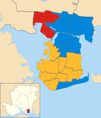
| current | 12:10, 1 February 2012 | | 1,055 × 1,226 (271 KB) | commons>Spiritofsussex | == {{int:filedesc}} == {{Information |Description=2010 local elections results on map of Portsmouth, Hampshire, UK with electoral wards shown. Equirectangular map projection on WGS 84 datum, with N/S stretched 155% Geographic limits: *West: 1.17W *East: |
File usage
There are no pages that use this file.