File:Portage County labeled.png
Jump to navigation
Jump to search

Size of this preview: 477 × 600 pixels. Other resolutions: 191 × 240 pixels | 489 × 615 pixels.
Original file (489 × 615 pixels, file size: 117 KB, MIME type: image/png)
Summary
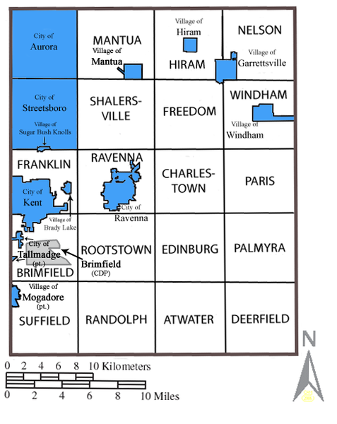
| Description | Map of Portage County, Ohio with municipal and township labels. Municipalities in blue; census-designated places in gray; townships in white. |
| Date | |
| Source | Own work |
| Author | JonRidinger |
| Permission (Reusing this file) |
This file is licensed under the Creative Commons Attribution 3.0 Unported license.
|
File history
Click on a date/time to view the file as it appeared at that time.
| Date/Time | Thumbnail | Dimensions | User | Comment | |
|---|---|---|---|---|---|
| current | 02:43, 16 May 2008 | | 489 × 615 (117 KB) | commons>JonRidinger | {{Information |Description= Map of Portage County, Ohio with municipal and township labels. Municipalities in blue; census-designated places in gray; townships in white. |Source=self-made |Date= 15 May 2008 |Author= JonRidinger |Perm |
File usage
There are no pages that use this file.