File:Port Royal Cays.png
Jump to navigation
Jump to search
Size of this preview: 800 × 540 pixels. Other resolutions: 320 × 216 pixels | 640 × 432 pixels | 1,021 × 689 pixels.
Original file (1,021 × 689 pixels, file size: 2.02 MB, MIME type: image/png)
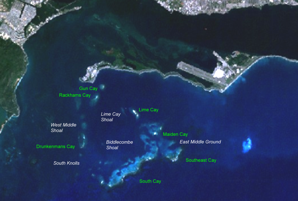
Summary
- NASA World Wind screenshot
- Landsat visible color
- 30 percent brightness added
- 10 percent contrast added
- islet names added by uploader - released in PD
- shoal names added by uploader - released in PD
- source of names: http://www.rumbletum.org/North%20America/Jamaica/Kingston-Saint+John/_3488980_Port+Royal.html#themap
Licensing
| This image is in the public domain because it is a screenshot from NASA’s globe software World Wind using a public domain layer, such as Blue Marble, MODIS, Landsat, SRTM, USGS or GLOBE.
|
 |
File history
Click on a date/time to view the file as it appeared at that time.
| Date/Time | Thumbnail | Dimensions | User | Comment | |
|---|---|---|---|---|---|
| current | 20:16, 29 June 2007 | | 1,021 × 689 (2.02 MB) | commons>Ratzer | *NASA World Wind screenshot *30 percent brightness added *10 percent contrast added *islet names added *shoal names added *source of names: http://www.rumbletum.org/North%20America/Jamaica/Kingston-Saint+John/_3488980_Port+Royal.html#themap |
File usage
There are no pages that use this file.