File:Polish-Lithuanian commonwealth 1619 map.png
Jump to navigation
Jump to search
No higher resolution available.
Polish-Lithuanian_commonwealth_1619_map.png (791 × 375 pixels, file size: 41 KB, MIME type: image/png)
File history
Click on a date/time to view the file as it appeared at that time.
| Date/Time | Thumbnail | Dimensions | User | Comment | |
|---|---|---|---|---|---|
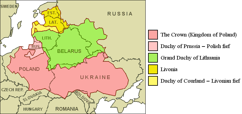
| current | 13:04, 29 August 2010 | | 791 × 375 (41 KB) | commons>Van der Hoorn | {{Information |Description={{en|1=Polish-Lithuanian Commonwealth (1619) compared with today's borders.}} |Source=JPEG-version with artifacts: File:Pol-lith_commonwealth_map.jpg |Author="Roel van der Hoorn (Van der Hoorn)" |Da |
File usage
There are no pages that use this file.