File:Piri Reis map of Europe and the Mediterranean Sea.jpg
Jump to navigation
Jump to search

Size of this preview: 800 × 550 pixels. Other resolutions: 320 × 220 pixels | 640 × 440 pixels | 1,024 × 704 pixels | 1,280 × 880 pixels | 2,000 × 1,375 pixels.
Original file (2,000 × 1,375 pixels, file size: 510 KB, MIME type: image/jpeg)
File history
Click on a date/time to view the file as it appeared at that time.
| Date/Time | Thumbnail | Dimensions | User | Comment | |
|---|---|---|---|---|---|
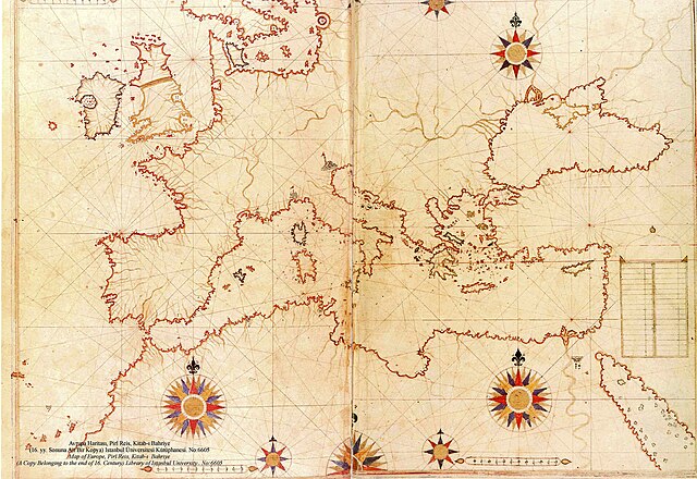
| current | 20:12, 5 August 2008 | | 2,000 × 1,375 (510 KB) | commons>Xauxa | {{Information |Description=Piri Reis map of Europe, the Mediterranean Sea and North Africa from his Kitab-ı Bahriye (Book of Navigation), 1521-1525 |Source=en:Piri Reis map of Europe and the Mediterranean Sea.jpg |Date=drawn 1513, uploaded on en:wik |
File usage
There are no pages that use this file.