File:Pecosmap.png
Jump to navigation
Jump to search
Size of this preview: 583 × 599 pixels. Other resolutions: 233 × 240 pixels | 467 × 480 pixels | 864 × 888 pixels.
Original file (864 × 888 pixels, file size: 860 KB, MIME type: image/png)
File history
Click on a date/time to view the file as it appeared at that time.
| Date/Time | Thumbnail | Dimensions | User | Comment | |
|---|---|---|---|---|---|
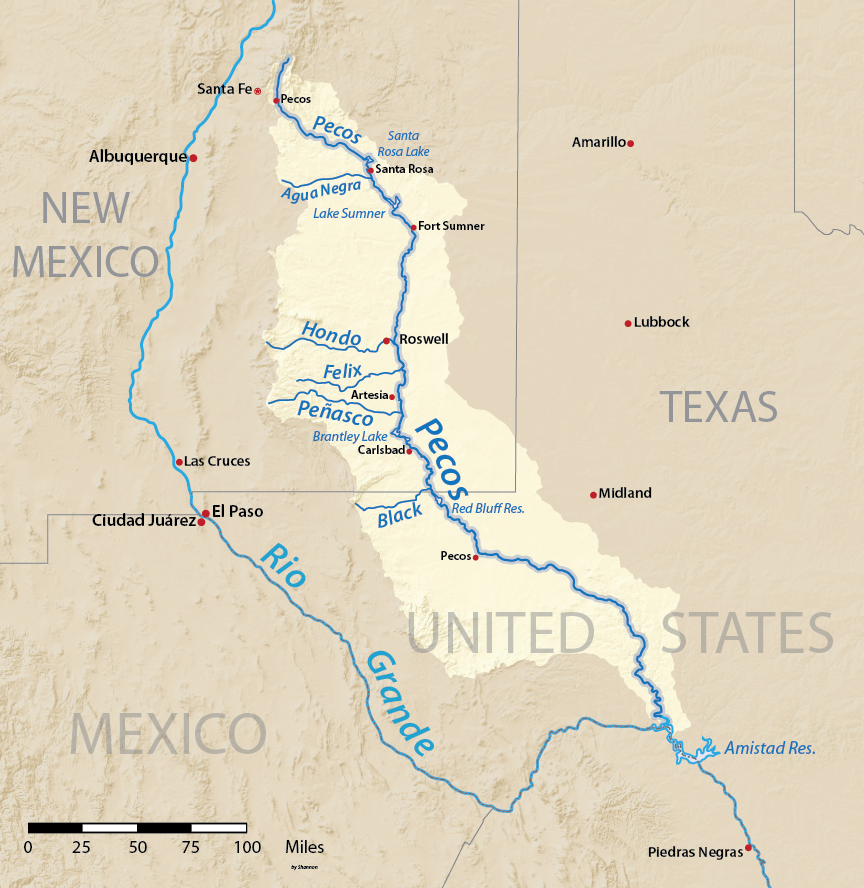
| current | 02:37, 31 March 2016 | | 864 × 888 (860 KB) | commons>Shannon1 | {{Information |Description ={{en|1=Map of the watershed of Pecos River, a tributary of the Rio Grande, in New Mexico and Texas, USA. Made using USGS National Map data.}} |Source =Own work |Author =Shannon1 |Date... |
File usage
There are no pages that use this file.