File:Panoramic Map Detail, Farmington, NH.jpg
Jump to navigation
Jump to search
No higher resolution available.
Panoramic_Map_Detail,_Farmington,_NH.jpg (316 × 349 pixels, file size: 41 KB, MIME type: image/jpeg)
File history
Click on a date/time to view the file as it appeared at that time.
| Date/Time | Thumbnail | Dimensions | User | Comment | |
|---|---|---|---|---|---|
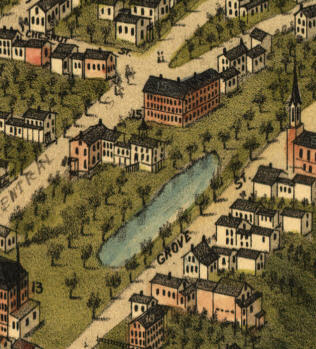
| current | 19:48, 17 June 2007 | | 316 × 349 (41 KB) | commons>Finnrind | {{Information |Description=Bird's-eye View of Farmington, NH; detail from an 1877 panoramic map. |Source=Originally from [http://en.wikipedia.org en.wikipedia]; description page is/was [http://en.wikipedia.org/w/index.php?title=Image%3APanoramic_Map_Deta |
File usage
There are no pages that use this file.