File:Oklahoma Tribal Areas.svg
Jump to navigation
Jump to search

Size of this PNG preview of this SVG file: 800 × 395 pixels. Other resolutions: 320 × 158 pixels | 640 × 316 pixels | 1,024 × 506 pixels | 1,280 × 632 pixels | 2,560 × 1,264 pixels.
Original file (SVG file, nominally 800 × 395 pixels, file size: 2.49 MB)
Summary
| Description |
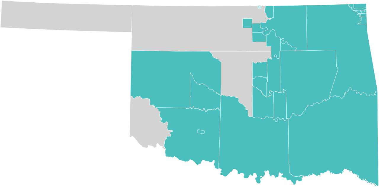
English: Map of Oklahoma showing Oklahoma Tribal Statistical Areas
Oklahoma tribal statistical area
Non-tribal land |
| Date | |
| Source | Own work based on Oklahoma Tribal Areas shapefiles |
| Author | Tcr25 |
Licensing
I, the copyright holder of this work, hereby publish it under the following license:
This file is licensed under the Creative Commons Attribution-Share Alike 4.0 International license.
- You are free:
- to share – to copy, distribute and transmit the work
- to remix – to adapt the work
- Under the following conditions:
- attribution – You must give appropriate credit, provide a link to the license, and indicate if changes were made. You may do so in any reasonable manner, but not in any way that suggests the licensor endorses you or your use.
- share alike – If you remix, transform, or build upon the material, you must distribute your contributions under the same or compatible license as the original.
File history
Click on a date/time to view the file as it appeared at that time.
| Date/Time | Thumbnail | Dimensions | User | Comment | |
|---|---|---|---|---|---|
| current | 14:56, 29 October 2020 | | 800 × 395 (2.49 MB) | commons>Tcr25 | change color for Greer County |
File usage
There are no pages that use this file.