File:Ogallala changes 1980-1995.svg
Jump to navigation
Jump to search

Size of this PNG preview of this SVG file: 455 × 599 pixels. Other resolutions: 182 × 240 pixels | 364 × 480 pixels | 583 × 768 pixels | 778 × 1,024 pixels | 1,555 × 2,048 pixels | 761 × 1,002 pixels.
Original file (SVG file, nominally 761 × 1,002 pixels, file size: 1.74 MB)
File history
Click on a date/time to view the file as it appeared at that time.
| Date/Time | Thumbnail | Dimensions | User | Comment | |
|---|---|---|---|---|---|
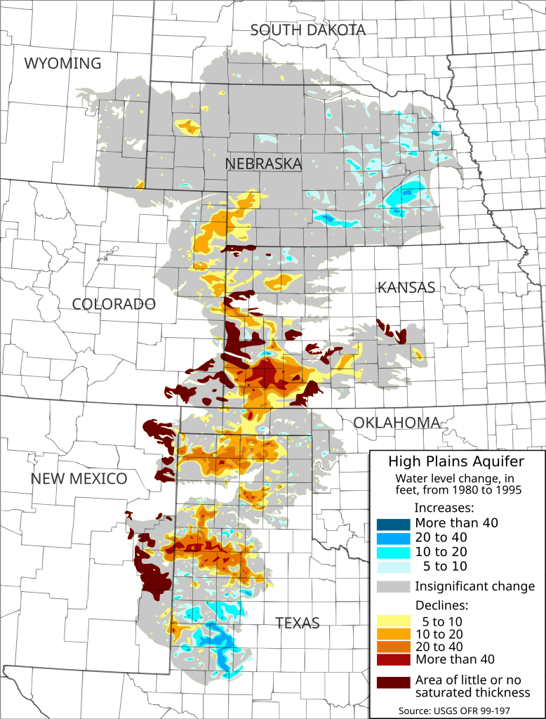
| current | 17:58, 28 February 2009 | | 761 × 1,002 (1.74 MB) | commons>Kbh3rd | {{Information |Description={{en|1=en|1=Map of water-level changes in the High Plains/Ogallala Aquifer in parts of Colorado, Kansas, Nebraska, New Mexico, Oklahoma, South Dakota, Texas, and Wyoming, 1980 to 1995. Created from [[:en:public domain|publ |
File usage
There are no pages that use this file.