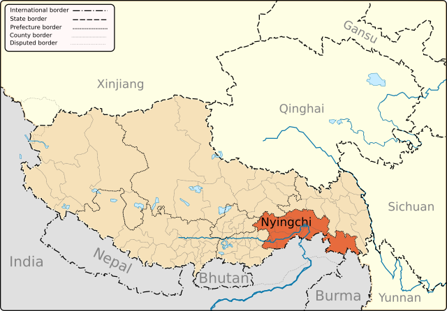
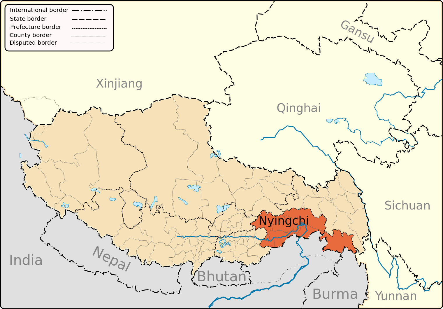
File:Nyingchi Prefecture map.svg
Jump to navigation
Jump to search

Size of this PNG preview of this SVG file: 800 × 557 pixels. Other resolutions: 320 × 223 pixels | 640 × 446 pixels | 1,024 × 713 pixels | 1,280 × 892 pixels | 2,560 × 1,784 pixels | 1,520 × 1,059 pixels.
Original file (SVG file, nominally 1,520 × 1,059 pixels, file size: 209 KB)
File history
Click on a date/time to view the file as it appeared at that time.
| Date/Time | Thumbnail | Dimensions | User | Comment | |
|---|---|---|---|---|---|
| current | 20:35, 7 May 2013 | | 1,520 × 1,059 (209 KB) | commons>Keithonearth | fixing Ngari/Shigatse prefecture boundary as pointed out by user:Fhah4, as per comment here: http://en.wikipedia.org/w/index.php?title=Wikipedia:Graphics_Lab/Map_workshop&diff=541288793&oldid=541266575 |
File usage
There are no pages that use this file.