File:Numbat historical map.png
Jump to navigation
Jump to search

Size of this preview: 663 × 600 pixels. Other resolutions: 265 × 240 pixels | 531 × 480 pixels | 849 × 768 pixels | 1,132 × 1,024 pixels | 2,000 × 1,809 pixels.
Original file (2,000 × 1,809 pixels, file size: 279 KB, MIME type: image/png)
File history
Click on a date/time to view the file as it appeared at that time.
| Date/Time | Thumbnail | Dimensions | User | Comment | |
|---|---|---|---|---|---|
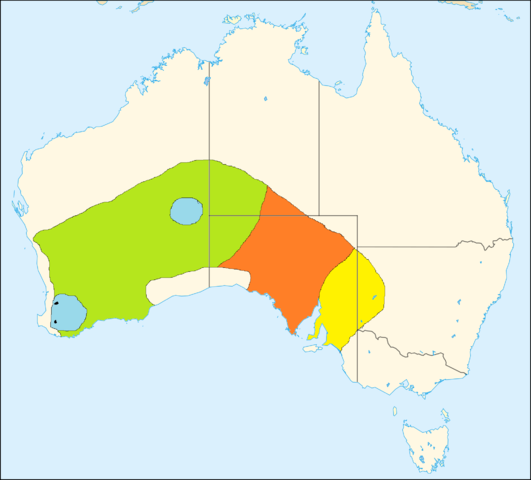
| current | 17:11, 22 January 2012 | | 2,000 × 1,809 (279 KB) | commons>Baldhur | == {{int:filedesc}} == {{Information |Description=Historical range map of the numbat (''Myrmecobius fasciatus'') yellow: became extinct between 1800 and 1910<br> orange: became extinct between 1910 and 1930<br> green: became extinct between 1930 and 1960 |
File usage
There are no pages that use this file.