File:North Sea location map.svg
Jump to navigation
Jump to search

Size of this PNG preview of this SVG file: 511 × 599 pixels. Other resolutions: 205 × 240 pixels | 409 × 480 pixels | 655 × 768 pixels | 873 × 1,024 pixels | 1,746 × 2,048 pixels | 988 × 1,159 pixels.
Original file (SVG file, nominally 988 × 1,159 pixels, file size: 582 KB)
File history
Click on a date/time to view the file as it appeared at that time.
| Date/Time | Thumbnail | Dimensions | User | Comment | |
|---|---|---|---|---|---|
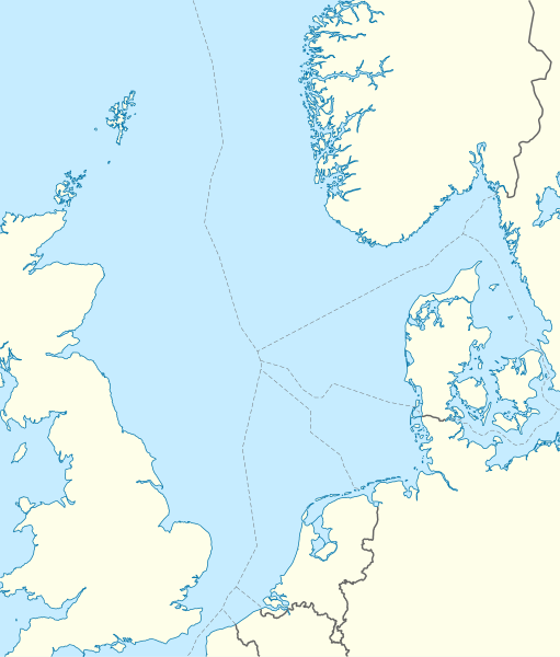
| current | 08:49, 18 June 2010 | | 988 × 1,159 (582 KB) | commons>NordNordWest | == {{int:filedesc}} == {{Information |Description= {{de|Positionskarte der Nordsee}} Quadratische Plattkarte, N-S-Streckung 180 %. Geographische Begrenzung der Karte: * N: 62.5° N * S: 50.5° N * W: 5.2° W * O: 13.2° O {{en|Location map |
File usage
There are no pages that use this file.