File:National Cycle Network Route 75 - geograph.org.uk - 709050.jpg
Jump to navigation
Jump to search

Size of this preview: 490 × 600 pixels. Other resolutions: 196 × 240 pixels | 523 × 640 pixels.
Original file (523 × 640 pixels, file size: 57 KB, MIME type: image/jpeg)
File history
Click on a date/time to view the file as it appeared at that time.
| Date/Time | Thumbnail | Dimensions | User | Comment | |
|---|---|---|---|---|---|
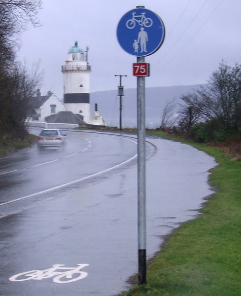
| current | 22:32, 18 February 2011 | | 523 × 640 (57 KB) | commons>GeographBot | == {{int:filedesc}} == {{Information |description={{en|1=National Cycle Network Route 75 This path at Cloch Road was recently converted to joint cycle path and footpath use. This is close to the west end of route 75 which currently stops at Lunderston bay |
File usage
There are no pages that use this file.