File:NODInundationMay2011Scenario1a.jpg
Jump to navigation
Jump to search

Size of this preview: 800 × 518 pixels. Other resolutions: 320 × 207 pixels | 640 × 414 pixels | 1,024 × 663 pixels | 1,280 × 829 pixels | 2,550 × 1,651 pixels.
Original file (2,550 × 1,651 pixels, file size: 977 KB, MIME type: image/jpeg)
File history
Click on a date/time to view the file as it appeared at that time.
| Date/Time | Thumbnail | Dimensions | User | Comment | |
|---|---|---|---|---|---|
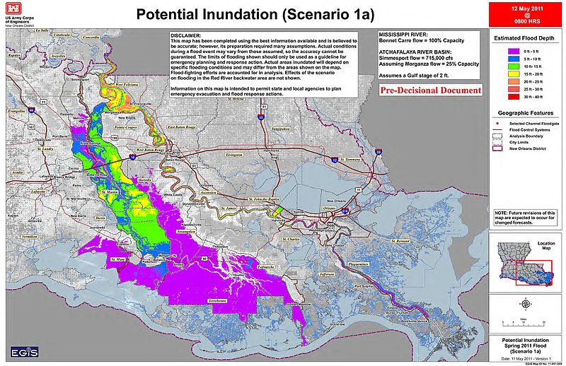
| current | 14:48, 14 May 2011 | | 2,550 × 1,651 (977 KB) | commons>Kkmurray | {{Information |Description ={{en|1=United States Army Corps of Engineers estimated Inundation Map Scenario 1a depicts the anticipated impacts from operation of the Morganza Floodway at 25% of its capacity with full operation of the Bonnet Carre’ Spil |
File usage
There are no pages that use this file.