File:NOAA map of Scotch Bonnet Ridge.jpg
Jump to navigation
Jump to search

Size of this preview: 800 × 545 pixels. Other resolutions: 320 × 218 pixels | 640 × 436 pixels | 1,024 × 697 pixels | 1,280 × 872 pixels | 2,560 × 1,743 pixels | 3,096 × 2,108 pixels.
Original file (3,096 × 2,108 pixels, file size: 5.17 MB, MIME type: image/jpeg)
File history
Click on a date/time to view the file as it appeared at that time.
| Date/Time | Thumbnail | Dimensions | User | Comment | |
|---|---|---|---|---|---|
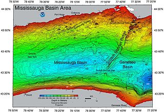
| current | 00:59, 23 June 2017 | | 3,096 × 2,108 (5.17 MB) | commons>Geo Swan | {{Information |Description=This {{w|NOAA}} map of {{w|Scotch Bonnet Ridge}} shows a central segment of {{w|Lake Ontario}}. |Source=https://ngdc.noaa.gov/mgg/greatlakes/lakeontario_cdrom/html/newnames.htm |Date= |Author= |Permission={{PD-USGov-NOAA}} |o... |
File usage
There are no pages that use this file.