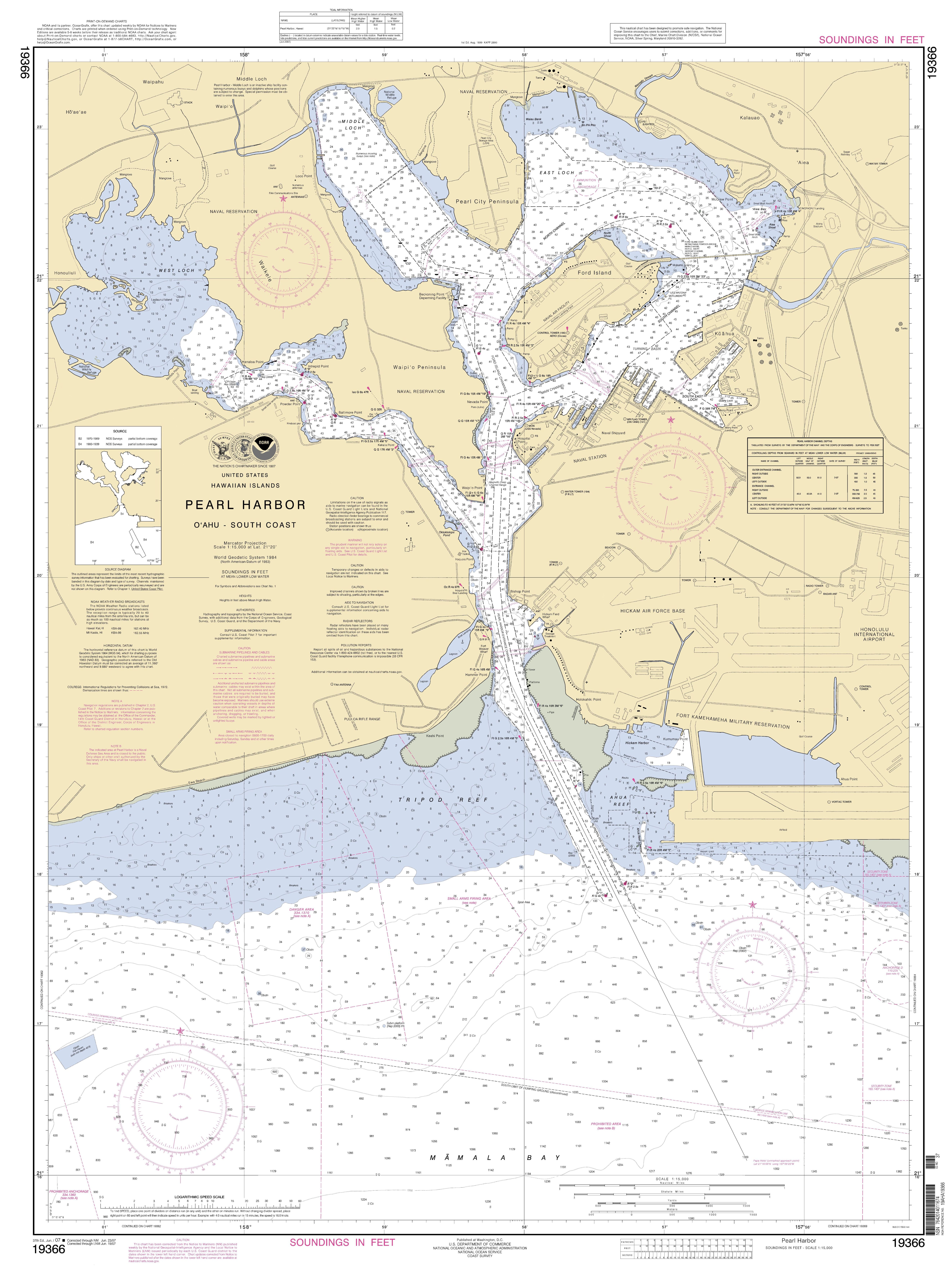
File:NOAA Pearl Harbor Approach Map.jpg
Jump to navigation
Jump to search
Size of this preview: 445 × 599 pixels. Other resolutions: 178 × 240 pixels | 356 × 480 pixels | 570 × 768 pixels | 761 × 1,024 pixels | 1,521 × 2,048 pixels | 5,291 × 7,123 pixels.
Original file (5,291 × 7,123 pixels, file size: 3.78 MB, MIME type: image/jpeg)
File history
Click on a date/time to view the file as it appeared at that time.
| Date/Time | Thumbnail | Dimensions | User | Comment | |
|---|---|---|---|---|---|
| current | 18:42, 25 May 2014 | | 5,291 × 7,123 (3.78 MB) | commons>TParis | Entire map |
File usage
There are no pages that use this file.