File:NASA Worldwind, USGS imagery map, Jersey Island and Bethel Island, California.png
Jump to navigation
Jump to search

Size of this preview: 800 × 472 pixels. Other resolutions: 320 × 189 pixels | 640 × 378 pixels | 856 × 505 pixels.
Original file (856 × 505 pixels, file size: 594 KB, MIME type: image/png)
File history
Click on a date/time to view the file as it appeared at that time.
| Date/Time | Thumbnail | Dimensions | User | Comment | |
|---|---|---|---|---|---|
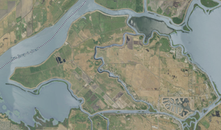
| current | 06:25, 17 September 2020 | | 856 × 505 (594 KB) | commons>JPxG | {{Information |description ={{en|1=Satellite map of Jersey Island and Bethel Island, California}} |date =2020-09-16 |source =NASA tool at worldwind.earth, USGS Topo Imagery map layer |author =Jacob Gotts |permission ={{PD-USGov-USGS}} }} Category:Islands of California |
File usage
There are no pages that use this file.