File:NAMrad Th let.gif
Jump to navigation
Jump to search
Size of this preview: 796 × 600 pixels. Other resolutions: 319 × 240 pixels | 637 × 480 pixels | 1,020 × 768 pixels | 1,236 × 931 pixels.
Original file (1,236 × 931 pixels, file size: 266 KB, MIME type: image/gif)
Summary
| Description |
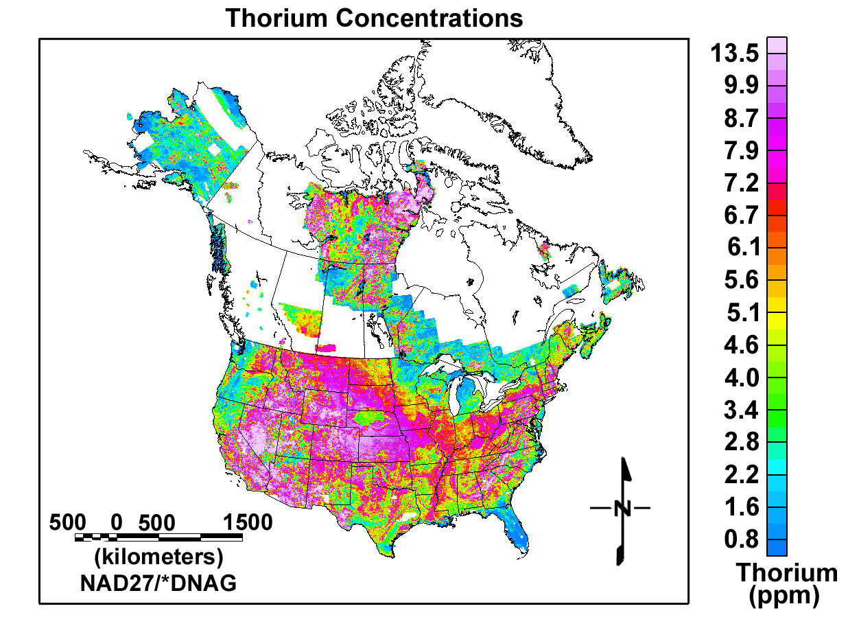
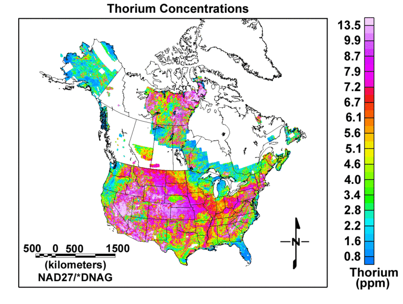
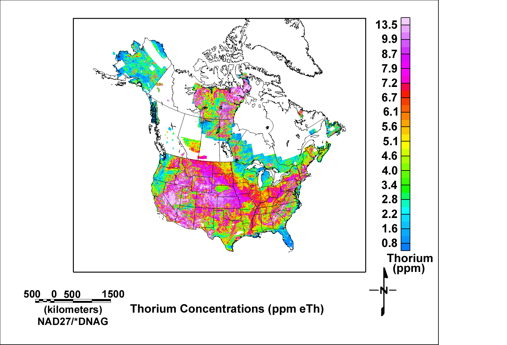
English: Map of Thorium Concentrations (most of USA and some of Canada) from USGS Open-File Report 2005-1413 |
| Date | |
| Source | http://pubs.usgs.gov/of/2005/1413/NAMrad_Th_let.gif via http://pubs.usgs.gov/of/2005/1413/maps.htm |
| Author | usgs.gov |
Licensing
This image is in the public domain in the United States because it only contains materials that originally came from the United States Geological Survey, an agency of the United States Department of the Interior. For more information, see the official USGS copyright policy.
|
File history
Click on a date/time to view the file as it appeared at that time.
| Date/Time | Thumbnail | Dimensions | User | Comment | |
|---|---|---|---|---|---|
| current | 02:58, 27 October 2011 | | 1,236 × 931 (266 KB) | commons>Limulus | cropped and moved key, title |
File usage
There are no pages that use this file.