File:Musee d'Orsay and Pont Royal, North-West view 140402 1.jpg
Jump to navigation
Jump to search

Size of this preview: 800 × 232 pixels. Other resolutions: 320 × 93 pixels | 640 × 186 pixels | 1,024 × 297 pixels | 1,280 × 371 pixels | 2,560 × 742 pixels | 11,745 × 3,406 pixels.
Original file (11,745 × 3,406 pixels, file size: 12.76 MB, MIME type: image/jpeg)
Summary
| Description |
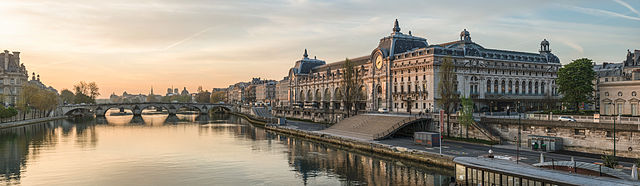
Français : Le Musée d'Orsay et le Pont Royal vus depuis la Passerelle Léopold-Sédar-Senghor au petit matin. English: The Musée d'Orsay and its surroundings as seen from the Passerelle Léopold Sédar Senghor
සිංහල: මියුසී ඩි'ඔරාසෙයි හා ඒ අවට, වයඹ දිග දැක්ම |
| Date | |
| Source | Own work |
| Author | DXR |
| Camera location | | View this and other nearby images on: OpenStreetMap |
|---|
|
This image was selected as picture of the day on Wikimedia Commons for 24 October 2014. It was captioned as follows: English: The Musée d'Orsay and the Seine river during sunrise Other languages:
Bosanski: Musée d'Orsay i rijeka Seine u vrijeme izlaska sunca. English: The Musée d'Orsay and the Seine river during sunrise Français : Le musée d'Orsay et le pont Royal vus depuis la passerelle Léopold-Sédar-Senghor au point du jour. Polski: Muzeum Orsay w Paryżu i Sekwana podczas wschodu słońca Русский: Музей Орсе в рассветные часы. |
|
|
Panorama by DXR (Category)
The photograph above is a panoramic image which was created by me, Daniel Vorndran, and uploaded here as User:DXR.
Please note:
|


Licensing
This file is licensed under the Creative Commons Attribution-Share Alike 3.0 Unported license.
Attribution: Daniel Vorndran / DXR
- You are free:
- to share – to copy, distribute and transmit the work
- to remix – to adapt the work
- Under the following conditions:
- attribution – You must give appropriate credit, provide a link to the license, and indicate if changes were made. You may do so in any reasonable manner, but not in any way that suggests the licensor endorses you or your use.
- share alike – If you remix, transform, or build upon the material, you must distribute your contributions under the same or compatible license as the original.
| Annotations | This image is annotated: View the annotations at Commons |
File history
Click on a date/time to view the file as it appeared at that time.
| Date/Time | Thumbnail | Dimensions | User | Comment | |
|---|---|---|---|---|---|
| current | 12:26, 3 April 2014 | 11,745 × 3,406 (12.76 MB) | commons>DXR | PC artifact removed |
File usage
There are no pages that use this file.