File:MtNapier Geol Map.png
Jump to navigation
Jump to search
Size of this preview: 800 × 579 pixels. Other resolutions: 320 × 232 pixels | 640 × 463 pixels | 1,024 × 741 pixels.
Original file (1,024 × 741 pixels, file size: 26 KB, MIME type: image/png)
File history
Click on a date/time to view the file as it appeared at that time.
| Date/Time | Thumbnail | Dimensions | User | Comment | |
|---|---|---|---|---|---|
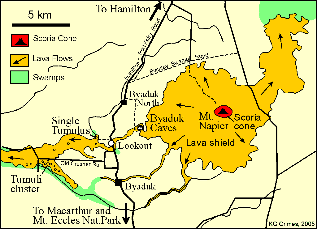
| current | 09:57, 19 September 2012 | | 1,024 × 741 (26 KB) | commons>KenG44 | {{Information |Description ={{en|1=Map of the Mt Napier volcano and lava flow Mount Napier}} |Source =Compiled by me in Corel Draw, for use in a variety of talks, handouts, field guides, interpretation signs etc |Author =K.G. Gri... |
File usage
There are no pages that use this file.