File:Montgomery-ADS-map.png
Jump to navigation
Jump to search
Size of this preview: 800 × 525 pixels. Other resolutions: 320 × 210 pixels | 640 × 420 pixels | 904 × 593 pixels.
Original file (904 × 593 pixels, file size: 449 KB, MIME type: image/png)
File history
Click on a date/time to view the file as it appeared at that time.
| Date/Time | Thumbnail | Dimensions | User | Comment | |
|---|---|---|---|---|---|
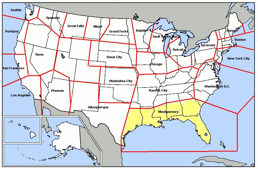
| current | 21:28, 20 February 2010 | | 904 × 593 (449 KB) | commons>Bwmoll3 | {{Information |Description={{en|1=Map of Montgomery Air Defense Sector (Air Defense Command)}} |Source={{own}} on public domain map of the united states |Author=Bwmoll3 |Date=20 Feb 2010 |Permission= |other_versions= }} |
File usage
There are no pages that use this file.